You are here: Home > Network List > IC - New China Digital Seismograph Network Stations List
> Station HIA Hailar, Neimenggu Autonomous Region, China > Earthquake Result Viewer
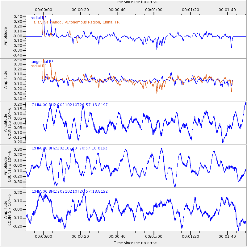
HIA Hailar, Neimenggu Autonomous Region, China - Earthquake Result Viewer
*The percent match for this event was below the threshold and hence no stack was calculated.
| Earthquake location: |
Southeast Of Loyalty Islands |
| Earthquake latitude/longitude: |
-22.8/171.1 |
| Earthquake time(UTC): |
2021/02/10 (041) 20:45:14 GMT |
| Earthquake Depth: |
10 km |
| Earthquake Magnitude: |
5.3 mb |
| Earthquake Catalog/Contributor: |
NEIC PDE/us |
|
| Network: |
IC New China Digital Seismograph Network |
| Station: |
HIA Hailar, Neimenggu Autonomous Region, China |
| Lat/Lon: |
49.27 N/119.74 E |
| Elevation: |
620 m |
|
| Distance: |
85.0 deg |
| Az: |
329.114 deg |
| Baz: |
133.664 deg |
| Ray Param: |
$rayparam |
*The percent match for this event was below the threshold and hence was not used in the summary stack. |
|
| Radial Match: |
64.590996 % |
| Radial Bump: |
306 |
| Transverse Match: |
44.731327 % |
| Transverse Bump: |
385 |
| SOD ConfigId: |
23341671 |
| Insert Time: |
2021-02-24 21:52:41.003 +0000 |
| GWidth: |
2.5 |
| Max Bumps: |
400 |
| Tol: |
0.001 |
|
Signal To Noise
| Channel | StoN | STA | LTA |
| IC:HIA:00:BHZ:20210210T20:57:18.819Z | 1.944375 | 1.5981013E-7 | 8.2190994E-8 |
| IC:HIA:00:BH1:20210210T20:57:18.819Z | 1.6654407 | 1.8031001E-7 | 1.08265645E-7 |
| IC:HIA:00:BH2:20210210T20:57:18.819Z | 0.96720904 | 9.492456E-8 | 9.8142756E-8 |
| Arrivals |
| Ps | |
| PpPs | |
| PsPs/PpSs | |


