You are here: Home > Network List > IC - New China Digital Seismograph Network Stations List
> Station HIA Hailar, Neimenggu Autonomous Region, China > Earthquake Result Viewer
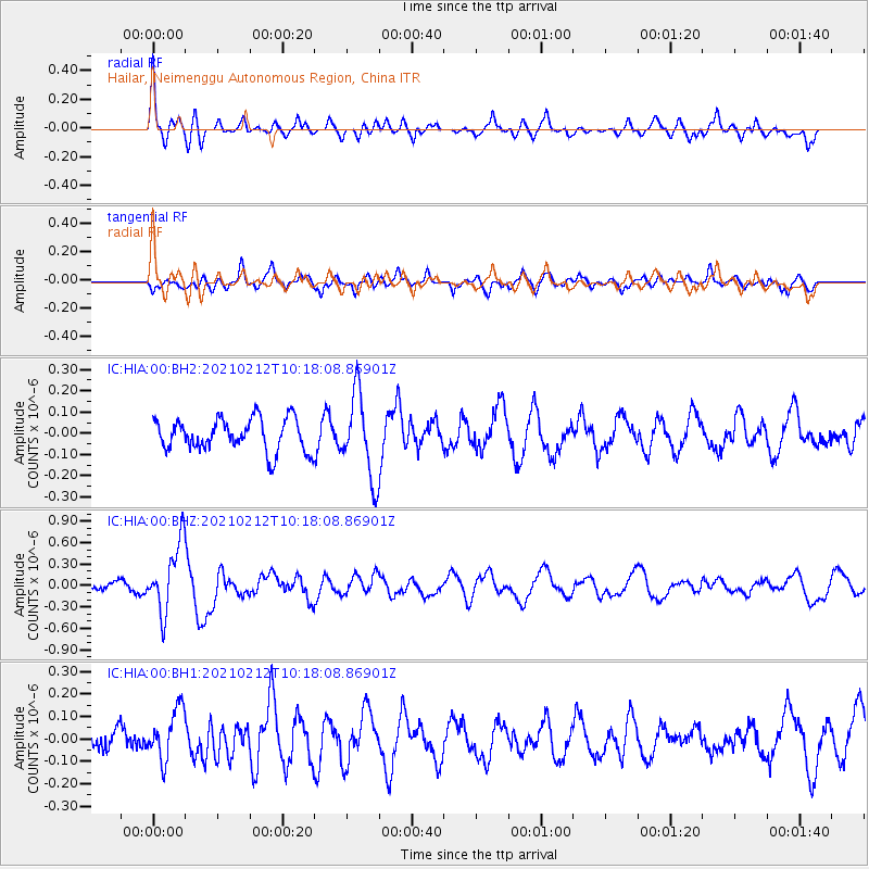
HIA Hailar, Neimenggu Autonomous Region, China - Earthquake Result Viewer
*The percent match for this event was below the threshold and hence no stack was calculated.
| Earthquake location: |
Southeast Of Loyalty Islands |
| Earthquake latitude/longitude: |
-23.2/171.6 |
| Earthquake time(UTC): |
2021/02/12 (043) 10:06:01 GMT |
| Earthquake Depth: |
10 km |
| Earthquake Magnitude: |
5.7 mww |
| Earthquake Catalog/Contributor: |
NEIC PDE/us |
|
| Network: |
IC New China Digital Seismograph Network |
| Station: |
HIA Hailar, Neimenggu Autonomous Region, China |
| Lat/Lon: |
49.27 N/119.74 E |
| Elevation: |
620 m |
|
| Distance: |
85.6 deg |
| Az: |
328.907 deg |
| Baz: |
133.505 deg |
| Ray Param: |
$rayparam |
*The percent match for this event was below the threshold and hence was not used in the summary stack. |
|
| Radial Match: |
71.38977 % |
| Radial Bump: |
400 |
| Transverse Match: |
75.2887 % |
| Transverse Bump: |
400 |
| SOD ConfigId: |
23341671 |
| Insert Time: |
2021-02-26 11:15:17.070 +0000 |
| GWidth: |
2.5 |
| Max Bumps: |
400 |
| Tol: |
0.001 |
|
Signal To Noise
| Channel | StoN | STA | LTA |
| IC:HIA:00:BHZ:20210212T10:18:08.86901Z | 5.344977 | 4.849967E-7 | 9.073878E-8 |
| IC:HIA:00:BH1:20210212T10:18:08.86901Z | 2.319716 | 1.1337753E-7 | 4.8875613E-8 |
| IC:HIA:00:BH2:20210212T10:18:08.86901Z | 2.5658329 | 1.9459948E-7 | 7.584262E-8 |
| Arrivals |
| Ps | |
| PpPs | |
| PsPs/PpSs | |


