You are here: Home > Network List > IC - New China Digital Seismograph Network Stations List
> Station HIA Hailar, Neimenggu Autonomous Region, China > Earthquake Result Viewer
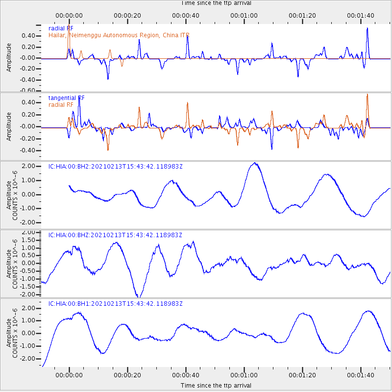
HIA Hailar, Neimenggu Autonomous Region, China - Earthquake Result Viewer
*The percent match for this event was below the threshold and hence no stack was calculated.
| Earthquake location: |
New Britain Region, P.N.G. |
| Earthquake latitude/longitude: |
-7.3/149.4 |
| Earthquake time(UTC): |
2021/02/13 (044) 15:33:57 GMT |
| Earthquake Depth: |
52 km |
| Earthquake Magnitude: |
6.0 Mww |
| Earthquake Catalog/Contributor: |
NEIC PDE/us |
|
| Network: |
IC New China Digital Seismograph Network |
| Station: |
HIA Hailar, Neimenggu Autonomous Region, China |
| Lat/Lon: |
49.27 N/119.74 E |
| Elevation: |
620 m |
|
| Distance: |
62.0 deg |
| Az: |
338.467 deg |
| Baz: |
146.229 deg |
| Ray Param: |
$rayparam |
*The percent match for this event was below the threshold and hence was not used in the summary stack. |
|
| Radial Match: |
69.962105 % |
| Radial Bump: |
326 |
| Transverse Match: |
74.010284 % |
| Transverse Bump: |
400 |
| SOD ConfigId: |
23341671 |
| Insert Time: |
2021-02-27 16:41:51.952 +0000 |
| GWidth: |
2.5 |
| Max Bumps: |
400 |
| Tol: |
0.001 |
|
Signal To Noise
| Channel | StoN | STA | LTA |
| IC:HIA:00:BHZ:20210213T15:43:42.118983Z | 0.9677783 | 1.0027106E-6 | 1.0360953E-6 |
| IC:HIA:00:BH1:20210213T15:43:42.118983Z | 1.2879072 | 1.6899846E-6 | 1.3121944E-6 |
| IC:HIA:00:BH2:20210213T15:43:42.118983Z | 2.21127 | 6.3013186E-7 | 2.849638E-7 |
| Arrivals |
| Ps | |
| PpPs | |
| PsPs/PpSs | |


