HARA XW.HARA - Earthquake Result Viewer
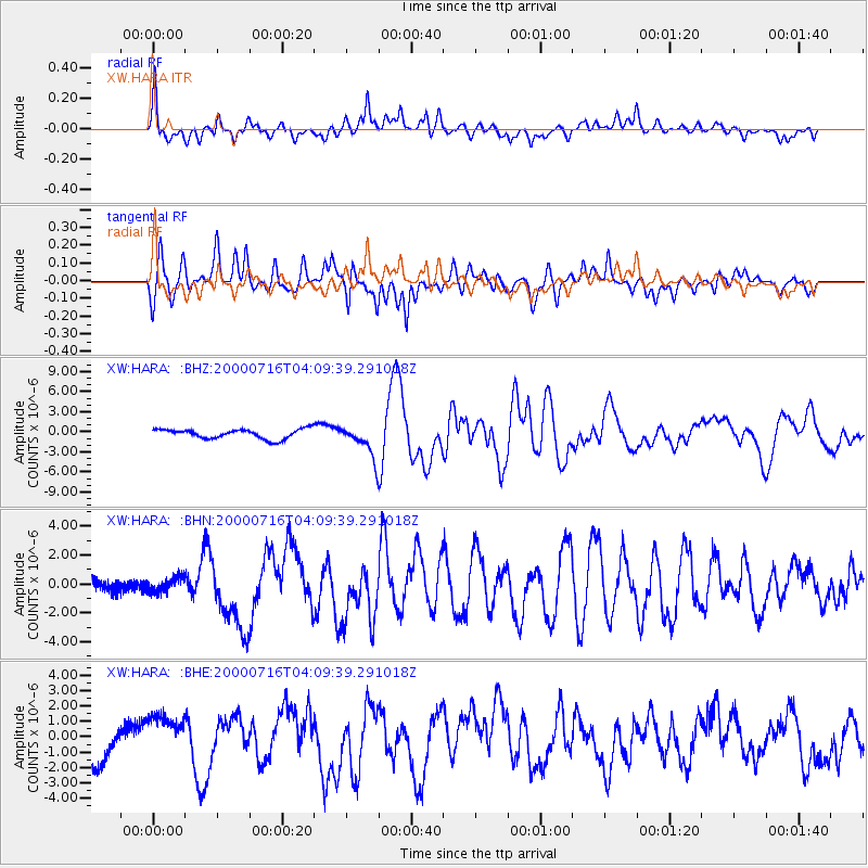
Earthquake location: New Britain Region, P.N.G.
Earthquake latitude/longitude: -7.7/150.9
Earthquake time(UTC): 2000/07/16 (198) 03:57:45 GMT
Earthquake Depth: 10 km
Earthquake Magnitude: 6.3 MB, 6.4 MS, 6.6 MW, 6.6 MW
Earthquake Catalog/Contributor: WHDF/NEIC
Network: XW Tien Shan Continental Dynamics
Station: HARA XW.HARA
Lat/Lon: 40.17 N/76.84 E
Elevation: 1585 m
Distance: 83.0 deg
Az: 312.064 deg
Baz: 106.222 deg
Ray Param: 0.04651095
Estimated Moho Depth: 67.5 km
Estimated Crust Vp/Vs: 1.95
Assumed Crust Vp: 6.491 km/s
Estimated Crust Vs: 3.329 km/s
Estimated Crust Poisson's Ratio: 0.32
Radial Match: 82.12749 %
Radial Bump: 400
Transverse Match: 78.389435 %
Transverse Bump: 400
SOD ConfigId: 20082
Insert Time: 2010-02-26 15:22:53.162 +0000
GWidth: 2.5
Max Bumps: 400
Tol: 0.001

Signal To Noise

ChannelStoNSTALTA
XW:HARA: :BHN:20000716T04:09:39.291018Z0.71343144.9077204E-76.8790365E-7
XW:HARA: :BHE:20000716T04:09:39.291018Z1.64103961.3989884E-68.525013E-7
XW:HARA: :BHZ:20000716T04:09:39.291018Z3.46972582.5014772E-67.209437E-7
Arrivals
Ps10 SECOND
PpPs30 SECOND
PsPs/PpSs40 SECOND