HARA XW.HARA - Earthquake Result Viewer
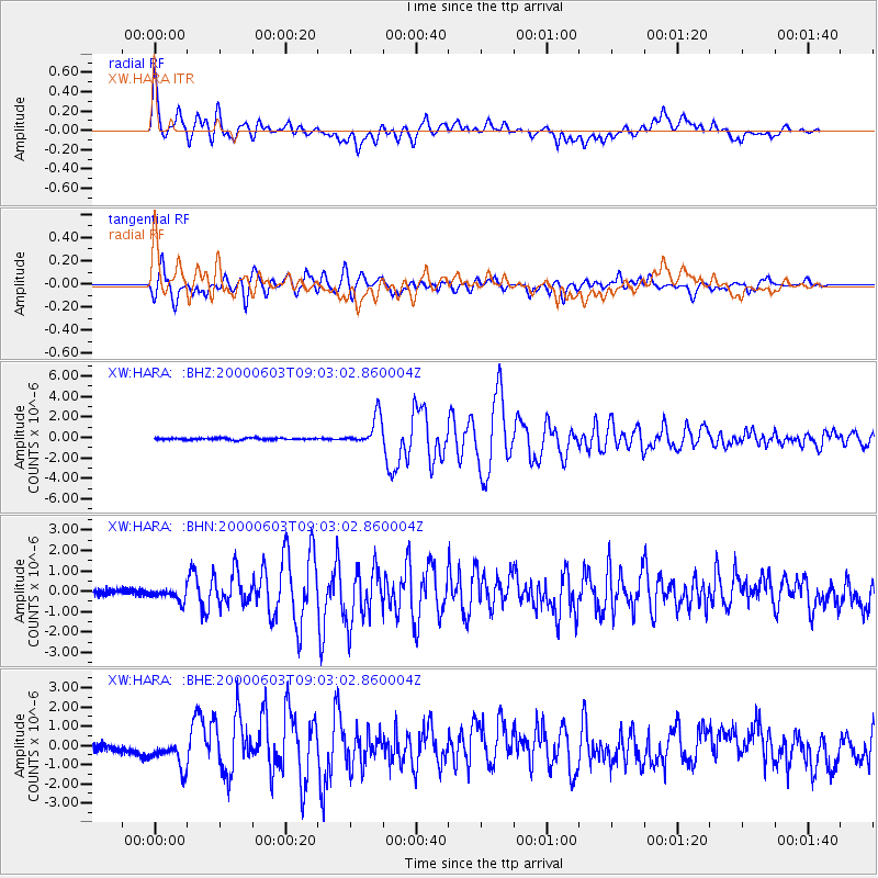
Earthquake location: Near East Coast Of Honshu, Japan
Earthquake latitude/longitude: 35.6/140.5
Earthquake time(UTC): 2000/06/03 (155) 08:54:49 GMT
Earthquake Depth: 62 km
Earthquake Magnitude: 5.6 MB, 5.6 MS, 6.1 MW, 6.1 MW
Earthquake Catalog/Contributor: WHDF/NEIC
Network: XW Tien Shan Continental Dynamics
Station: HARA XW.HARA
Lat/Lon: 40.17 N/76.84 E
Elevation: 1585 m
Distance: 49.5 deg
Az: 295.468 deg
Baz: 73.907 deg
Ray Param: 0.06849069
Estimated Moho Depth: 25.75 km
Estimated Crust Vp/Vs: 1.60
Assumed Crust Vp: 6.491 km/s
Estimated Crust Vs: 4.05 km/s
Estimated Crust Poisson's Ratio: 0.18
Radial Match: 91.11802 %
Radial Bump: 400
Transverse Match: 92.177574 %
Transverse Bump: 400
SOD ConfigId: 20082
Insert Time: 2010-02-26 15:23:10.545 +0000
GWidth: 2.5
Max Bumps: 400
Tol: 0.001

Signal To Noise

ChannelStoNSTALTA
XW:HARA: :BHN:20000603T09:03:02.860004Z1.7872783.00746E-71.6827039E-7
XW:HARA: :BHE:20000603T09:03:02.860004Z2.9411087.8042984E-72.6535233E-7
XW:HARA: :BHZ:20000603T09:03:02.860004Z16.4518321.436422E-68.731077E-8
Arrivals
Ps2.6 SECOND
PpPs9.7 SECOND
PsPs/PpSs12 SECOND