HARA XW.HARA - Earthquake Result Viewer
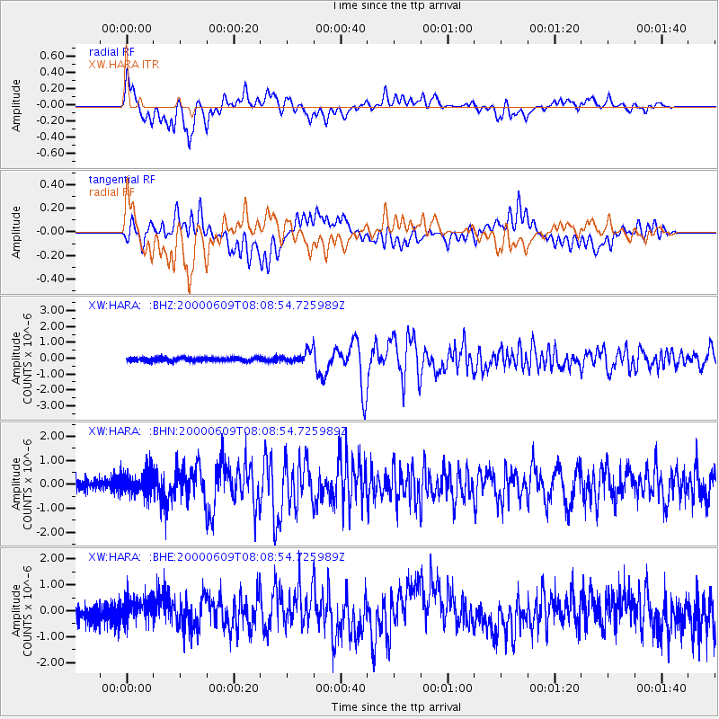
Earthquake location: Southern Sumatra, Indonesia
Earthquake latitude/longitude: -5.5/102.7
Earthquake time(UTC): 2000/06/09 (161) 08:00:24 GMT
Earthquake Depth: 33 km
Earthquake Magnitude: 5.8 MB, 5.8 MS, 6.0 MW, 6.0 MW
Earthquake Catalog/Contributor: WHDF/NEIC
Network: XW Tien Shan Continental Dynamics
Station: HARA XW.HARA
Lat/Lon: 40.17 N/76.84 E
Elevation: 1585 m
Distance: 51.3 deg
Az: 334.678 deg
Baz: 146.246 deg
Ray Param: 0.06741519
Estimated Moho Depth: 63.5 km
Estimated Crust Vp/Vs: 1.96
Assumed Crust Vp: 6.491 km/s
Estimated Crust Vs: 3.316 km/s
Estimated Crust Poisson's Ratio: 0.32
Radial Match: 85.83103 %
Radial Bump: 400
Transverse Match: 79.061134 %
Transverse Bump: 400
SOD ConfigId: 3744
Insert Time: 2010-02-26 15:23:22.735 +0000
GWidth: 2.5
Max Bumps: 400
Tol: 0.001

Signal To Noise

ChannelStoNSTALTA
XW:HARA: :BHN:20000609T08:08:54.725989Z1.82903244.572251E-72.4998195E-7
XW:HARA: :BHE:20000609T08:08:54.725989Z1.42578224.3165875E-73.0275226E-7
XW:HARA: :BHZ:20000609T08:08:54.725989Z3.53951293.9495617E-71.11584896E-7
Arrivals
Ps9.9 SECOND
PpPs27 SECOND
PsPs/PpSs37 SECOND