HARA XW.HARA - Earthquake Result Viewer
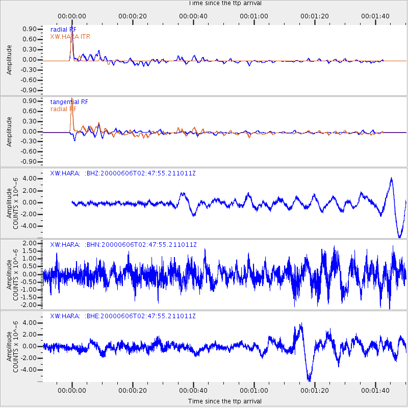
Earthquake location: Turkey
Earthquake latitude/longitude: 40.7/33.0
Earthquake time(UTC): 2000/06/06 (158) 02:41:49 GMT
Earthquake Depth: 10 km
Earthquake Magnitude: 5.5 MB, 6.1 MS, 6.1 MW, 6.0 MW
Earthquake Catalog/Contributor: WHDF/NEIC
Network: XW Tien Shan Continental Dynamics
Station: HARA XW.HARA
Lat/Lon: 40.17 N/76.84 E
Elevation: 1585 m
Distance: 33.1 deg
Az: 76.269 deg
Baz: 285.418 deg
Ray Param: 0.07835482
Estimated Moho Depth: 49.0 km
Estimated Crust Vp/Vs: 1.75
Assumed Crust Vp: 6.491 km/s
Estimated Crust Vs: 3.72 km/s
Estimated Crust Poisson's Ratio: 0.26
Radial Match: 88.153564 %
Radial Bump: 389
Transverse Match: 67.87663 %
Transverse Bump: 400
SOD ConfigId: 3744
Insert Time: 2010-02-26 15:23:25.594 +0000
GWidth: 2.5
Max Bumps: 400
Tol: 0.001

Signal To Noise

ChannelStoNSTALTA
XW:HARA: :BHN:20000606T02:47:55.211011Z0.88372313.1993048E-73.6202573E-7
XW:HARA: :BHE:20000606T02:47:55.211011Z1.36439444.830127E-73.5401249E-7
XW:HARA: :BHZ:20000606T02:47:55.211011Z1.76245653.0808548E-71.7480458E-7
Arrivals
Ps6.1 SECOND
PpPs19 SECOND
PsPs/PpSs25 SECOND