You are here: Home > Network List > IC - New China Digital Seismograph Network Stations List
> Station HIA Hailar, Neimenggu Autonomous Region, China > Earthquake Result Viewer
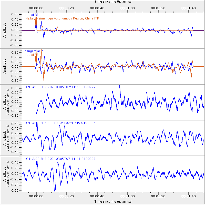
HIA Hailar, Neimenggu Autonomous Region, China - Earthquake Result Viewer
*The percent match for this event was below the threshold and hence no stack was calculated.
| Earthquake location: |
Southern Sumatra, Indonesia |
| Earthquake latitude/longitude: |
-1.8/99.2 |
| Earthquake time(UTC): |
2021/03/05 (064) 07:32:54 GMT |
| Earthquake Depth: |
18 km |
| Earthquake Magnitude: |
5.6 Mww |
| Earthquake Catalog/Contributor: |
NEIC PDE/us |
|
| Network: |
IC New China Digital Seismograph Network |
| Station: |
HIA Hailar, Neimenggu Autonomous Region, China |
| Lat/Lon: |
49.27 N/119.74 E |
| Elevation: |
620 m |
|
| Distance: |
53.9 deg |
| Az: |
16.526 deg |
| Baz: |
205.726 deg |
| Ray Param: |
$rayparam |
*The percent match for this event was below the threshold and hence was not used in the summary stack. |
|
| Radial Match: |
56.3923 % |
| Radial Bump: |
400 |
| Transverse Match: |
60.128914 % |
| Transverse Bump: |
400 |
| SOD ConfigId: |
23341671 |
| Insert Time: |
2021-03-19 08:36:53.316 +0000 |
| GWidth: |
2.5 |
| Max Bumps: |
400 |
| Tol: |
0.001 |
|
Signal To Noise
| Channel | StoN | STA | LTA |
| IC:HIA:00:BHZ:20210305T07:41:45.019022Z | 3.8407323 | 3.4123147E-7 | 8.884542E-8 |
| IC:HIA:00:BH1:20210305T07:41:45.019022Z | 2.821497 | 2.1477169E-7 | 7.611977E-8 |
| IC:HIA:00:BH2:20210305T07:41:45.019022Z | 1.174503 | 9.39991E-8 | 8.003309E-8 |
| Arrivals |
| Ps | |
| PpPs | |
| PsPs/PpSs | |


