HLQI XW.HLQI - Earthquake Result Viewer
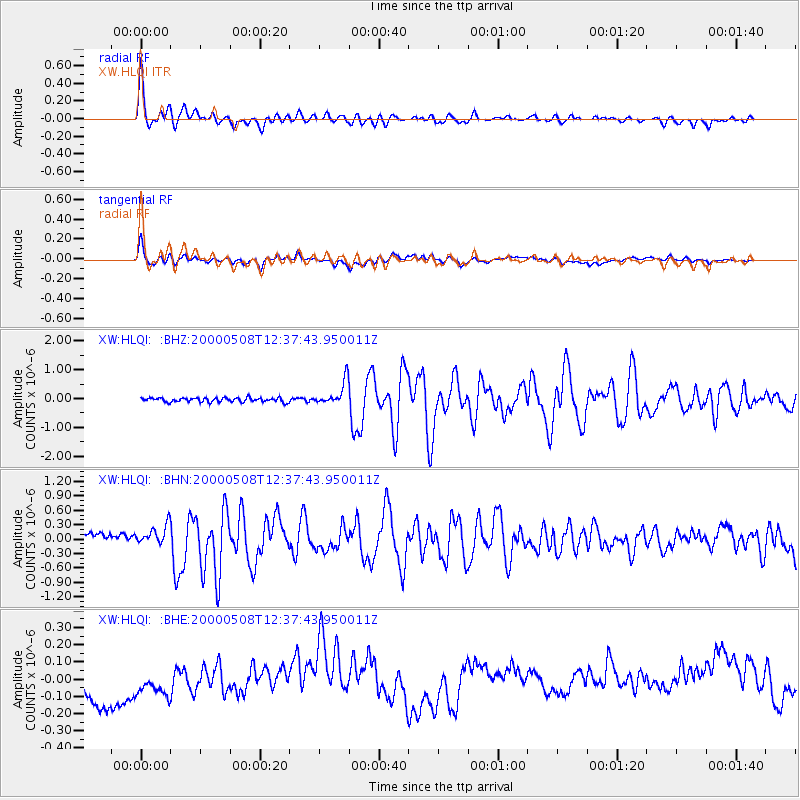
Earthquake location: Southwest Of Sumatra, Indonesia
Earthquake latitude/longitude: -0.8/98.0
Earthquake time(UTC): 2000/05/08 (129) 12:29:59 GMT
Earthquake Depth: 33 km
Earthquake Magnitude: 5.6 MB, 5.3 MS, 5.9 MW, 5.6 MW
Earthquake Catalog/Contributor: WHDF/NEIC
Network: XW Tien Shan Continental Dynamics
Station: HLQI XW.HLQI
Lat/Lon: 40.84 N/77.96 E
Elevation: 2241 m
Distance: 45.3 deg
Az: 338.562 deg
Baz: 151.204 deg
Ray Param: 0.07128892
Estimated Moho Depth: 64.75 km
Estimated Crust Vp/Vs: 1.84
Assumed Crust Vp: 6.491 km/s
Estimated Crust Vs: 3.532 km/s
Estimated Crust Poisson's Ratio: 0.29
Radial Match: 86.32923 %
Radial Bump: 400
Transverse Match: 63.381195 %
Transverse Bump: 400
SOD ConfigId: 20082
Insert Time: 2010-02-26 15:23:44.870 +0000
GWidth: 2.5
Max Bumps: 400
Tol: 0.001

Signal To Noise

ChannelStoNSTALTA
XW:HLQI: :BHN:20000508T12:37:43.950011Z1.97657191.9951325E-71.0093903E-7
XW:HLQI: :BHE:20000508T12:37:43.950011Z1.08011251.15521146E-71.0695289E-7
XW:HLQI: :BHZ:20000508T12:37:43.950011Z5.82439764.1144435E-77.064153E-8
Arrivals
Ps8.9 SECOND
PpPs27 SECOND
PsPs/PpSs35 SECOND