HLQI XW.HLQI - Earthquake Result Viewer
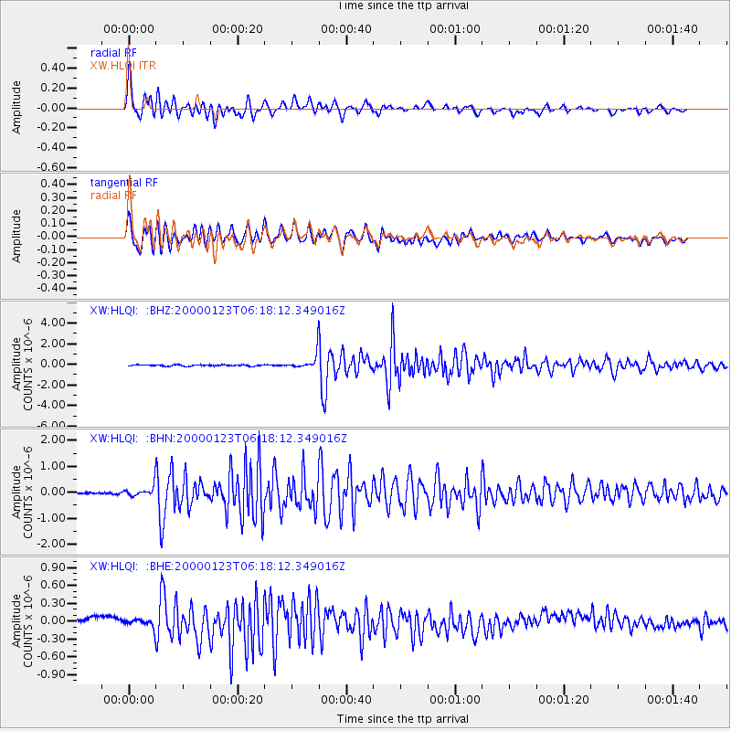
Earthquake location: Flores Sea
Earthquake latitude/longitude: -8.0/120.6
Earthquake time(UTC): 2000/01/23 (023) 06:08:24 GMT
Earthquake Depth: 47 km
Earthquake Magnitude: 5.7 MB, 5.2 MS, 5.8 MW, 5.7 MW
Earthquake Catalog/Contributor: WHDF/NEIC
Network: XW Tien Shan Continental Dynamics
Station: HLQI XW.HLQI
Lat/Lon: 40.84 N/77.96 E
Elevation: 2241 m
Distance: 62.4 deg
Az: 324.555 deg
Baz: 130.791 deg
Ray Param: 0.060139693
Estimated Moho Depth: 34.0 km
Estimated Crust Vp/Vs: 2.01
Assumed Crust Vp: 6.491 km/s
Estimated Crust Vs: 3.225 km/s
Estimated Crust Poisson's Ratio: 0.34
Radial Match: 86.27934 %
Radial Bump: 400
Transverse Match: 84.652855 %
Transverse Bump: 400
SOD ConfigId: 20082
Insert Time: 2010-02-26 15:23:49.772 +0000
GWidth: 2.5
Max Bumps: 400
Tol: 0.001

Signal To Noise

ChannelStoNSTALTA
XW:HLQI: :BHN:20000123T06:18:12.349016Z2.98000621.9468216E-76.5329445E-8
XW:HLQI: :BHE:20000123T06:18:12.349016Z1.3116486.7398E-85.138421E-8
XW:HLQI: :BHZ:20000123T06:18:12.349016Z12.8638427.941369E-76.1734035E-8
Arrivals
Ps5.5 SECOND
PpPs15 SECOND
PsPs/PpSs21 SECOND