HLQI XW.HLQI - Earthquake Result Viewer
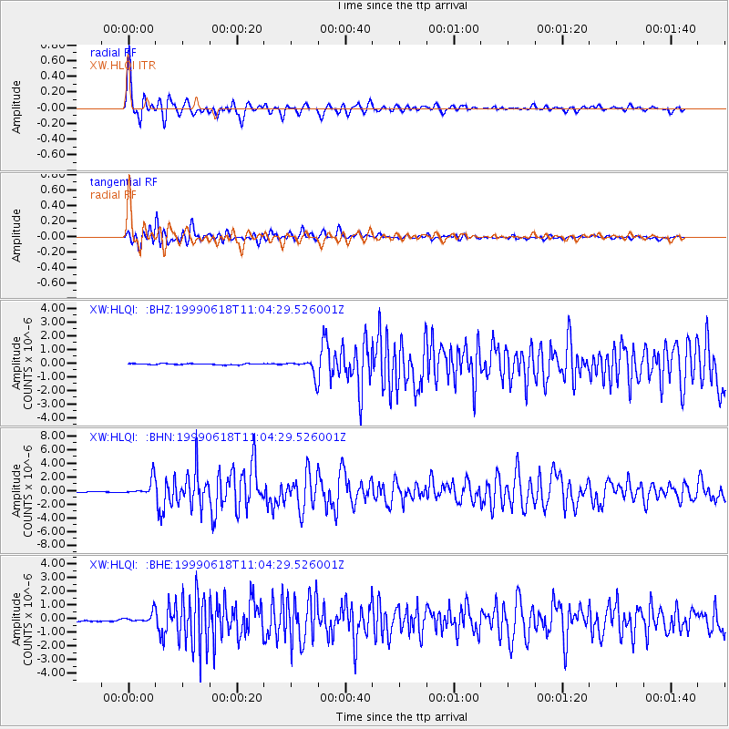
Earthquake location: Mindanao, Philippines
Earthquake latitude/longitude: 5.5/126.6
Earthquake time(UTC): 1999/06/18 (169) 10:55:25 GMT
Earthquake Depth: 33 km
Earthquake Magnitude: 6.1 MB, 6.1 MS, 6.4 MW, 6.4 MW
Earthquake Catalog/Contributor: WHDF/NEIC
Network: XW Tien Shan Continental Dynamics
Station: HLQI XW.HLQI
Lat/Lon: 40.84 N/77.96 E
Elevation: 2241 m
Distance: 55.9 deg
Az: 316.512 deg
Baz: 115.452 deg
Ray Param: 0.064444155
Estimated Moho Depth: 28.0 km
Estimated Crust Vp/Vs: 1.65
Assumed Crust Vp: 6.491 km/s
Estimated Crust Vs: 3.934 km/s
Estimated Crust Poisson's Ratio: 0.21
Radial Match: 92.86332 %
Radial Bump: 400
Transverse Match: 90.83537 %
Transverse Bump: 400
SOD ConfigId: 4480
Insert Time: 2010-02-26 15:23:55.141 +0000
GWidth: 2.5
Max Bumps: 400
Tol: 0.001

Signal To Noise

ChannelStoNSTALTA
XW:HLQI: :BHN:19990618T11:04:29.526001Z17.9959471.2402447E-66.8918E-8
XW:HLQI: :BHE:19990618T11:04:29.526001Z6.78045273.7612986E-75.5472675E-8
XW:HLQI: :BHZ:19990618T11:04:29.526001Z14.2048795.9278256E-74.1730914E-8
Arrivals
Ps3.0 SECOND
PpPs11 SECOND
PsPs/PpSs14 SECOND