KAI XW.KAI - Earthquake Result Viewer
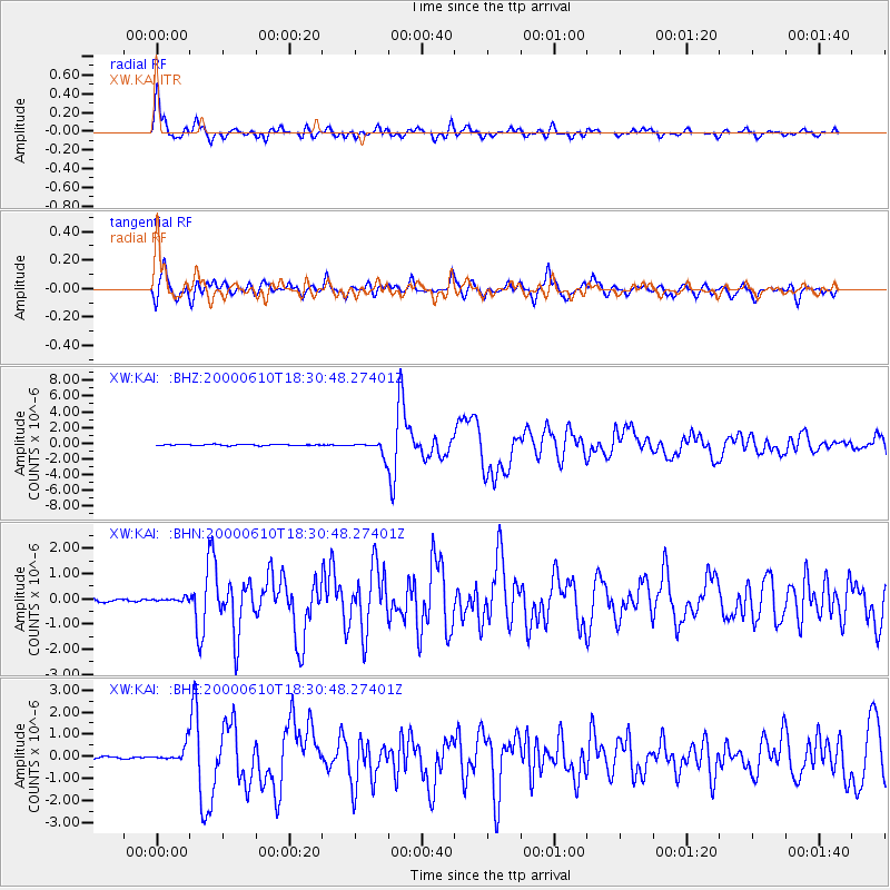
Earthquake location: Taiwan
Earthquake latitude/longitude: 23.8/121.2
Earthquake time(UTC): 2000/06/10 (162) 18:23:29 GMT
Earthquake Depth: 33 km
Earthquake Magnitude: 6.2 MB, 6.2 MS, 6.4 MW, 6.3 MW
Earthquake Catalog/Contributor: WHDF/NEIC
Network: XW Tien Shan Continental Dynamics
Station: KAI XW.KAI
Lat/Lon: 41.57 N/75.01 E
Elevation: 2016 m
Distance: 42.2 deg
Az: 306.205 deg
Baz: 100.055 deg
Ray Param: 0.073268
Estimated Moho Depth: 61.0 km
Estimated Crust Vp/Vs: 1.60
Assumed Crust Vp: 6.491 km/s
Estimated Crust Vs: 4.057 km/s
Estimated Crust Poisson's Ratio: 0.18
Radial Match: 86.40693 %
Radial Bump: 400
Transverse Match: 74.691 %
Transverse Bump: 400
SOD ConfigId: 20082
Insert Time: 2010-02-26 15:24:02.683 +0000
GWidth: 2.5
Max Bumps: 400
Tol: 0.001

Signal To Noise

ChannelStoNSTALTA
XW:KAI: :BHN:20000610T18:30:48.27401Z1.40643366.940332E-84.934703E-8
XW:KAI: :BHE:20000610T18:30:48.27401Z10.2407763.613956E-73.5289865E-8
XW:KAI: :BHZ:20000610T18:30:48.27401Z11.9366089.007854E-77.54641E-8
Arrivals
Ps6.1 SECOND
PpPs23 SECOND
PsPs/PpSs29 SECOND