KAI XW.KAI - Earthquake Result Viewer
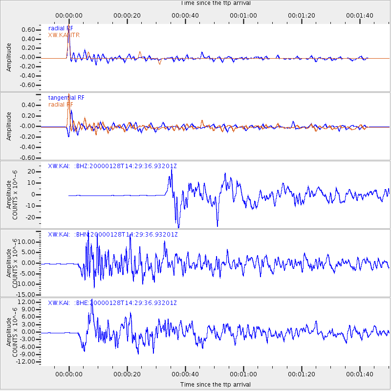
Earthquake location: Kuril Islands
Earthquake latitude/longitude: 43.0/146.8
Earthquake time(UTC): 2000/01/28 (028) 14:21:07 GMT
Earthquake Depth: 61 km
Earthquake Magnitude: 6.7 MB, 6.6 MS, 6.8 MW, 6.8 ME
Earthquake Catalog/Contributor: WHDF/NEIC
Network: XW Tien Shan Continental Dynamics
Station: KAI XW.KAI
Lat/Lon: 41.57 N/75.01 E
Elevation: 2016 m
Distance: 51.6 deg
Az: 294.532 deg
Baz: 62.72 deg
Ray Param: 0.06713885
Estimated Moho Depth: 24.25 km
Estimated Crust Vp/Vs: 1.87
Assumed Crust Vp: 6.491 km/s
Estimated Crust Vs: 3.471 km/s
Estimated Crust Poisson's Ratio: 0.30
Radial Match: 93.44406 %
Radial Bump: 400
Transverse Match: 82.53402 %
Transverse Bump: 400
SOD ConfigId: 20082
Insert Time: 2010-02-26 15:24:17.259 +0000
GWidth: 2.5
Max Bumps: 400
Tol: 0.001

Signal To Noise

ChannelStoNSTALTA
XW:KAI: :BHN:20000128T14:29:36.93201Z28.1556361.821276E-66.468601E-8
XW:KAI: :BHE:20000128T14:29:36.93201Z45.680321.9416905E-64.2506063E-8
XW:KAI: :BHZ:20000128T14:29:36.93201Z61.958415.3243903E-68.5934914E-8
Arrivals
Ps3.4 SECOND
PpPs10 SECOND
PsPs/PpSs14 SECOND