KAI XW.KAI - Earthquake Result Viewer
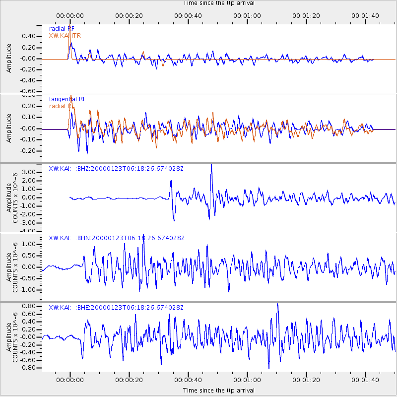
Earthquake location: Flores Sea
Earthquake latitude/longitude: -8.0/120.6
Earthquake time(UTC): 2000/01/23 (023) 06:08:24 GMT
Earthquake Depth: 47 km
Earthquake Magnitude: 5.7 MB, 5.2 MS, 5.8 MW, 5.7 MW
Earthquake Catalog/Contributor: WHDF/NEIC
Network: XW Tien Shan Continental Dynamics
Station: KAI XW.KAI
Lat/Lon: 41.57 N/75.01 E
Elevation: 2016 m
Distance: 64.6 deg
Az: 323.594 deg
Baz: 128.426 deg
Ray Param: 0.058726843
Estimated Moho Depth: 59.75 km
Estimated Crust Vp/Vs: 2.00
Assumed Crust Vp: 6.491 km/s
Estimated Crust Vs: 3.25 km/s
Estimated Crust Poisson's Ratio: 0.33
Radial Match: 81.77132 %
Radial Bump: 400
Transverse Match: 84.61973 %
Transverse Bump: 400
SOD ConfigId: 20082
Insert Time: 2010-02-26 15:24:18.788 +0000
GWidth: 2.5
Max Bumps: 400
Tol: 0.001

Signal To Noise

ChannelStoNSTALTA
XW:KAI: :BHN:20000123T06:18:26.674028Z1.81544111.5543206E-78.561669E-8
XW:KAI: :BHE:20000123T06:18:26.674028Z3.6455351.68044E-74.609584E-8
XW:KAI: :BHZ:20000123T06:18:26.674028Z8.9984816.6413537E-77.380528E-8
Arrivals
Ps9.5 SECOND
PpPs27 SECOND
PsPs/PpSs36 SECOND