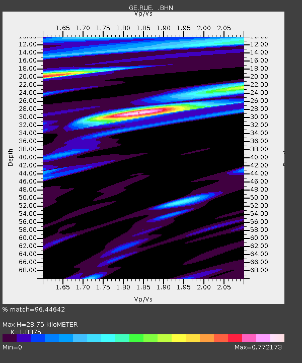
RUE GRSN/GEOFON Station Ruedersdorf, Germany - Earthquake Result Viewer

Earthquake location: Andreanof Islands, Aleutian Is.
Earthquake latitude/longitude: 51.2/-179.3
Earthquake time(UTC): 2006/07/08 (189) 20:40:00 GMT
Earthquake Depth: 22 km
Earthquake Magnitude: 6.2 MB, 6.4 MS, 6.6 MW, 6.6 MW
Earthquake Catalog/Contributor: WHDF/NEIC
Network: GE GEOFON
Station: RUE GRSN/GEOFON Station Ruedersdorf, Germany
Lat/Lon: 52.48 N/13.78 E
Elevation: 40 m
Distance: 76.1 deg
Az: 351.794 deg
Baz: 8.44 deg
Ray Param: 0.05120194
Estimated Moho Depth: 28.75 km
Estimated Crust Vp/Vs: 1.84
Assumed Crust Vp: 6.039 km/s
Estimated Crust Vs: 3.286 km/s
Estimated Crust Poisson's Ratio: 0.29
Radial Match: 96.44642 %
Radial Bump: 394
Transverse Match: 80.37057 %
Transverse Bump: 400
SOD ConfigId: 2665
Insert Time: 2010-03-09 06:16:27.724 +0000
GWidth: 2.5
Max Bumps: 400
Tol: 0.001

Signal To Noise

ChannelStoNSTALTA
GE:RUE: :BHN:20060708T20:51:15.620015Z6.5132135.5715003E-78.55415E-8
GE:RUE: :BHE:20060708T20:51:15.620015Z1.68086921.4058489E-78.3638206E-8
GE:RUE: :BHZ:20060708T20:51:15.620015Z15.1172161.3498924E-68.929504E-8
Arrivals
Ps4.1 SECOND
PpPs13 SECOND
PsPs/PpSs17 SECOND