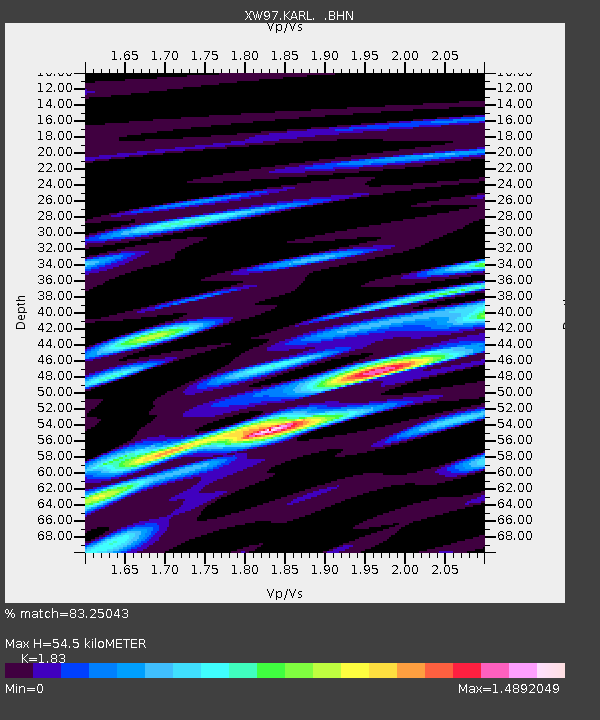
KARL XW.KARL - Earthquake Result Viewer
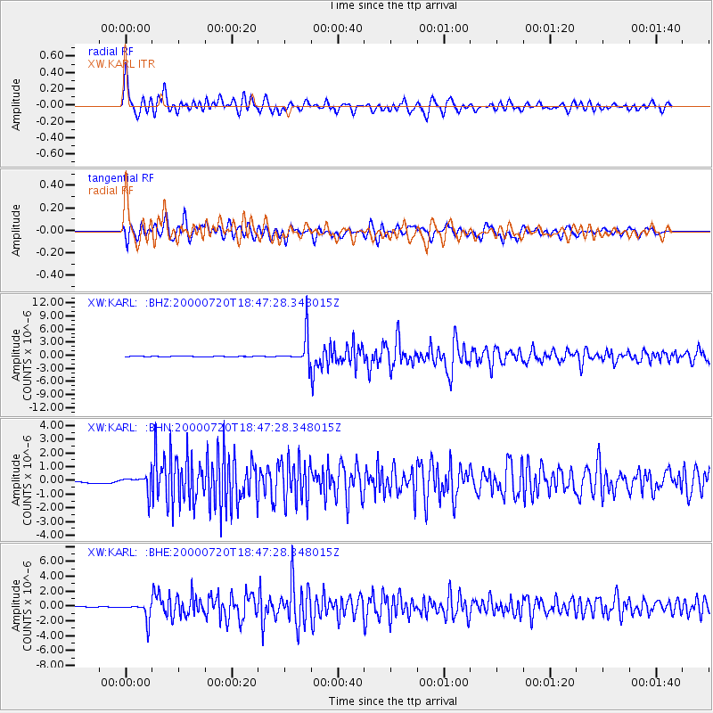
Earthquake location: Near East Coast Of Honshu, Japan
Earthquake latitude/longitude: 36.5/141.0
Earthquake time(UTC): 2000/07/20 (202) 18:39:18 GMT
Earthquake Depth: 47 km
Earthquake Magnitude: 6.1 MB, 5.4 MS, 6.1 ME, 6.0 MW
Earthquake Catalog/Contributor: WHDF/NEIC
Network: XW Tien Shan Continental Dynamics
Station: KARL XW.KARL
Lat/Lon: 41.47 N/77.31 E
Elevation: 3021 m
Distance: 48.8 deg
Az: 296.386 deg
Baz: 73.827 deg
Ray Param: 0.069031335
Estimated Moho Depth: 54.5 km
Estimated Crust Vp/Vs: 1.83
Assumed Crust Vp: 6.491 km/s
Estimated Crust Vs: 3.547 km/s
Estimated Crust Poisson's Ratio: 0.29
Radial Match: 83.25043 %
Radial Bump: 400
Transverse Match: 75.02878 %
Transverse Bump: 400
SOD ConfigId: 20082
Insert Time: 2010-02-26 15:26:25.467 +0000
GWidth: 2.5
Max Bumps: 400
Tol: 0.001

Signal To Noise

ChannelStoNSTALTA
XW:KARL: :BHN:20000720T18:47:28.348015Z5.970076.1488913E-71.029953E-7
XW:KARL: :BHE:20000720T18:47:28.348015Z24.0918581.2111474E-65.0272064E-8
XW:KARL: :BHZ:20000720T18:47:28.348015Z75.3587653.410219E-64.5253117E-8
Arrivals
Ps7.4 SECOND
PpPs22 SECOND
PsPs/PpSs30 SECOND