KARL XW.KARL - Earthquake Result Viewer
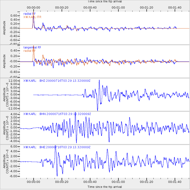
Earthquake location: Philippine Islands Region
Earthquake latitude/longitude: 20.3/122.0
Earthquake time(UTC): 2000/07/16 (198) 03:21:45 GMT
Earthquake Depth: 33 km
Earthquake Magnitude: 6.1 MB, 6.3 MS, 6.4 MW, 6.4 MW
Earthquake Catalog/Contributor: WHDF/NEIC
Network: XW Tien Shan Continental Dynamics
Station: KARL XW.KARL
Lat/Lon: 41.47 N/77.31 E
Elevation: 3021 m
Distance: 43.3 deg
Az: 309.486 deg
Baz: 105.355 deg
Ray Param: 0.07260034
Estimated Moho Depth: 63.75 km
Estimated Crust Vp/Vs: 1.63
Assumed Crust Vp: 6.491 km/s
Estimated Crust Vs: 3.97 km/s
Estimated Crust Poisson's Ratio: 0.20
Radial Match: 96.03013 %
Radial Bump: 338
Transverse Match: 92.740654 %
Transverse Bump: 400
SOD ConfigId: 20082
Insert Time: 2010-02-26 15:26:26.980 +0000
GWidth: 2.5
Max Bumps: 400
Tol: 0.001

Signal To Noise

ChannelStoNSTALTA
XW:KARL: :BHN:20000716T03:29:13.320009Z1.2408741.0476636E-78.442948E-8
XW:KARL: :BHE:20000716T03:29:13.320009Z1.77125221.0100953E-75.702719E-8
XW:KARL: :BHZ:20000716T03:29:13.320009Z2.8147671.729895E-76.145785E-8
Arrivals
Ps6.7 SECOND
PpPs24 SECOND
PsPs/PpSs31 SECOND