KARL XW.KARL - Earthquake Result Viewer
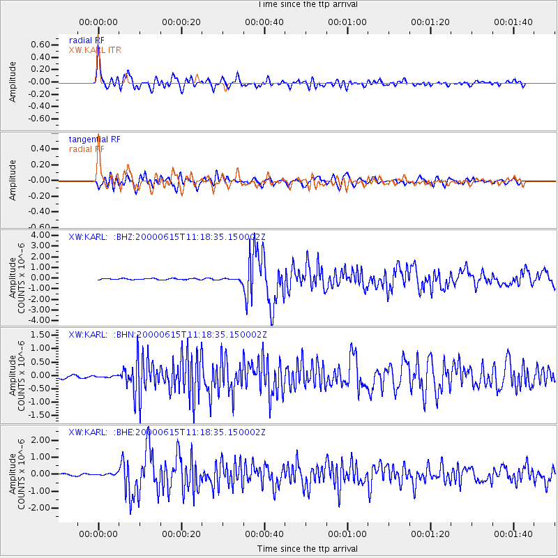
Earthquake location: Southeast Of Shikoku, Japan
Earthquake latitude/longitude: 29.4/132.1
Earthquake time(UTC): 2000/06/15 (167) 11:10:46 GMT
Earthquake Depth: 10 km
Earthquake Magnitude: 6.0 MB, 5.6 MS, 6.1 MW, 6.1 MW
Earthquake Catalog/Contributor: WHDF/NEIC
Network: XW Tien Shan Continental Dynamics
Station: KARL XW.KARL
Lat/Lon: 41.47 N/77.31 E
Elevation: 3021 m
Distance: 45.6 deg
Az: 300.696 deg
Baz: 87.233 deg
Ray Param: 0.07120378
Estimated Moho Depth: 54.75 km
Estimated Crust Vp/Vs: 1.71
Assumed Crust Vp: 6.491 km/s
Estimated Crust Vs: 3.796 km/s
Estimated Crust Poisson's Ratio: 0.24
Radial Match: 89.83548 %
Radial Bump: 400
Transverse Match: 83.08288 %
Transverse Bump: 400
SOD ConfigId: 20082
Insert Time: 2010-02-26 15:26:45.313 +0000
GWidth: 2.5
Max Bumps: 400
Tol: 0.001

Signal To Noise

ChannelStoNSTALTA
XW:KARL: :BHN:20000615T11:18:35.150002Z0.47960613.218123E-86.709929E-8
XW:KARL: :BHE:20000615T11:18:35.150002Z1.45552567.232664E-84.969108E-8
XW:KARL: :BHZ:20000615T11:18:35.150002Z2.58513141.3818286E-75.3452933E-8
Arrivals
Ps6.4 SECOND
PpPs21 SECOND
PsPs/PpSs28 SECOND