KARL XW.KARL - Earthquake Result Viewer
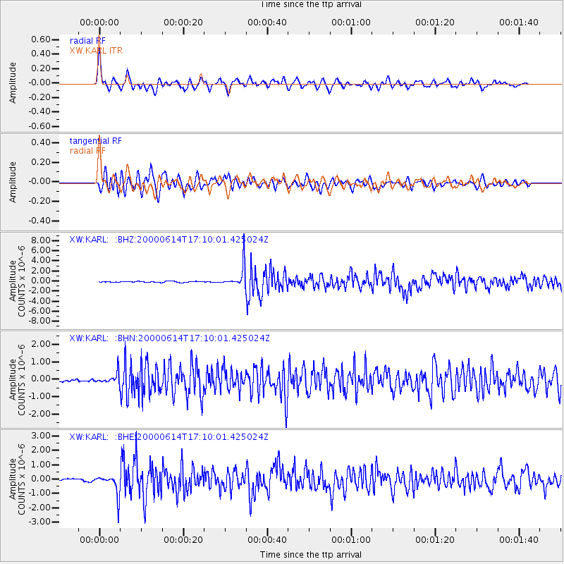
Earthquake location: Talaud Islands, Indonesia
Earthquake latitude/longitude: 4.5/127.7
Earthquake time(UTC): 2000/06/14 (166) 17:00:48 GMT
Earthquake Depth: 90 km
Earthquake Magnitude: 6.1 MB, 5.6 MS, 6.4 MW, 6.3 MW
Earthquake Catalog/Contributor: WHDF/NEIC
Network: XW Tien Shan Continental Dynamics
Station: KARL XW.KARL
Lat/Lon: 41.47 N/77.31 E
Elevation: 3021 m
Distance: 58.0 deg
Az: 316.955 deg
Baz: 115.109 deg
Ray Param: 0.06284791
Estimated Moho Depth: 62.75 km
Estimated Crust Vp/Vs: 1.64
Assumed Crust Vp: 6.491 km/s
Estimated Crust Vs: 3.946 km/s
Estimated Crust Poisson's Ratio: 0.21
Radial Match: 89.02087 %
Radial Bump: 400
Transverse Match: 84.09192 %
Transverse Bump: 400
SOD ConfigId: 20082
Insert Time: 2010-02-26 15:26:46.654 +0000
GWidth: 2.5
Max Bumps: 400
Tol: 0.001

Signal To Noise

ChannelStoNSTALTA
XW:KARL: :BHN:20000614T17:10:01.425024Z4.18907173.1904537E-77.6161356E-8
XW:KARL: :BHE:20000614T17:10:01.425024Z10.7554537.338529E-76.8230776E-8
XW:KARL: :BHZ:20000614T17:10:01.425024Z22.5875232.1194357E-69.383215E-8
Arrivals
Ps6.6 SECOND
PpPs24 SECOND
PsPs/PpSs31 SECOND