
KARL XW.KARL - Earthquake Result Viewer
| ||||||||||||||||||
| ||||||||||||||||||
| ||||||||||||||||||
|
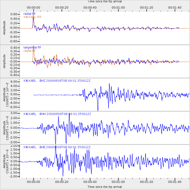
Signal To Noise
| Channel | StoN | STA | LTA |
| XW:KARL: :BHN:20000609T08:09:01.350012Z | 2.4540286 | 8.896656E-8 | 3.625327E-8 |
| XW:KARL: :BHE:20000609T08:09:01.350012Z | 1.3758255 | 4.1883613E-8 | 3.0442532E-8 |
| XW:KARL: :BHZ:20000609T08:09:01.350012Z | 6.402939 | 2.696995E-7 | 4.2121208E-8 |
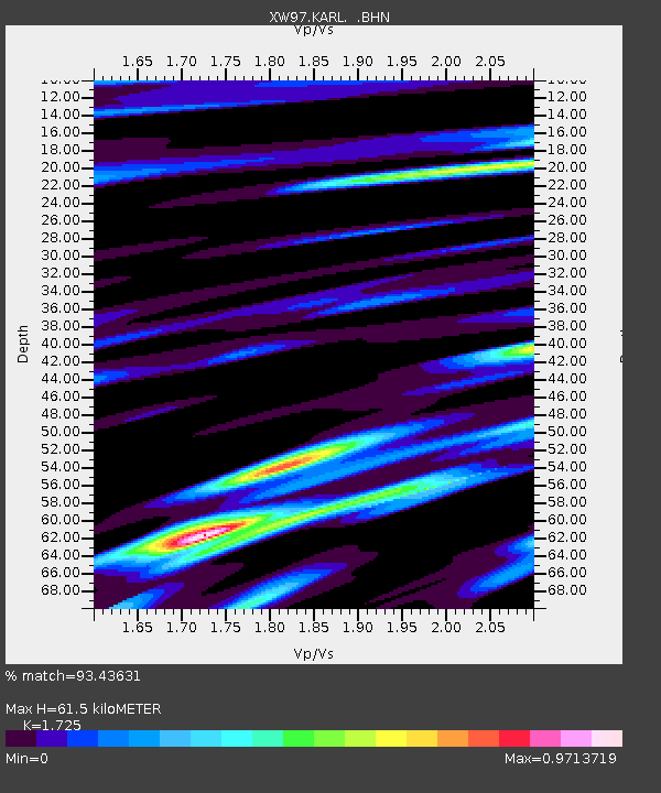
| Arrivals | |
| Ps | 7.3 SECOND |
| PpPs | 24 SECOND |
| PsPs/PpSs | 32 SECOND |

