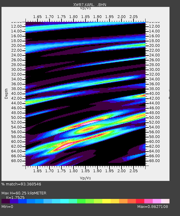
KARL XW.KARL - Earthquake Result Viewer
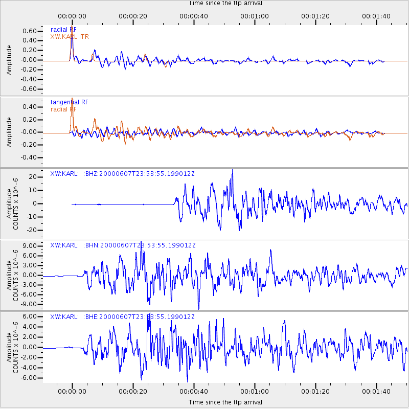
Earthquake location: Southern Sumatra, Indonesia
Earthquake latitude/longitude: -4.6/101.9
Earthquake time(UTC): 2000/06/07 (159) 23:45:26 GMT
Earthquake Depth: 33 km
Earthquake Magnitude: 6.1 MB, 6.7 MS, 6.7 MW, 6.5 MW
Earthquake Catalog/Contributor: WHDF/NEIC
Network: XW Tien Shan Continental Dynamics
Station: KARL XW.KARL
Lat/Lon: 41.47 N/77.31 E
Elevation: 3021 m
Distance: 51.1 deg
Az: 336.292 deg
Baz: 147.768 deg
Ray Param: 0.067585625
Estimated Moho Depth: 60.25 km
Estimated Crust Vp/Vs: 1.75
Assumed Crust Vp: 6.491 km/s
Estimated Crust Vs: 3.704 km/s
Estimated Crust Poisson's Ratio: 0.26
Radial Match: 93.368546 %
Radial Bump: 400
Transverse Match: 79.330734 %
Transverse Bump: 400
SOD ConfigId: 20082
Insert Time: 2010-02-26 15:26:51.974 +0000
GWidth: 2.5
Max Bumps: 400
Tol: 0.001

Signal To Noise

ChannelStoNSTALTA
XW:KARL: :BHN:20000607T23:53:55.199012Z5.8450015.2774146E-79.028937E-8
XW:KARL: :BHE:20000607T23:53:55.199012Z4.69185544.0215576E-78.571359E-8
XW:KARL: :BHZ:20000607T23:53:55.199012Z15.4783791.6115436E-61.04115784E-7
Arrivals
Ps7.4 SECOND
PpPs24 SECOND
PsPs/PpSs31 SECOND