KARL XW.KARL - Earthquake Result Viewer
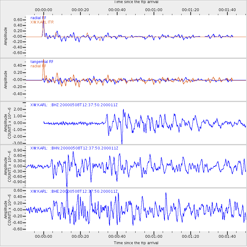
Earthquake location: Southwest Of Sumatra, Indonesia
Earthquake latitude/longitude: -0.8/98.0
Earthquake time(UTC): 2000/05/08 (129) 12:29:59 GMT
Earthquake Depth: 33 km
Earthquake Magnitude: 5.6 MB, 5.3 MS, 5.9 MW, 5.6 MW
Earthquake Catalog/Contributor: WHDF/NEIC
Network: XW Tien Shan Continental Dynamics
Station: KARL XW.KARL
Lat/Lon: 41.47 N/77.31 E
Elevation: 3021 m
Distance: 46.1 deg
Az: 338.386 deg
Baz: 150.652 deg
Ray Param: 0.07078381
Estimated Moho Depth: 52.5 km
Estimated Crust Vp/Vs: 1.86
Assumed Crust Vp: 6.491 km/s
Estimated Crust Vs: 3.499 km/s
Estimated Crust Poisson's Ratio: 0.30
Radial Match: 90.44802 %
Radial Bump: 400
Transverse Match: 85.91719 %
Transverse Bump: 400
SOD ConfigId: 20082
Insert Time: 2010-02-26 15:27:07.393 +0000
GWidth: 2.5
Max Bumps: 400
Tol: 0.001

Signal To Noise

ChannelStoNSTALTA
XW:KARL: :BHN:20000508T12:37:50.200011Z2.61665271.4086699E-75.38348E-8
XW:KARL: :BHE:20000508T12:37:50.200011Z2.07221488.935396E-84.3120025E-8
XW:KARL: :BHZ:20000508T12:37:50.200011Z4.64410924.4988806E-79.6872846E-8
Arrivals
Ps7.4 SECOND
PpPs22 SECOND
PsPs/PpSs29 SECOND