KARL XW.KARL - Earthquake Result Viewer
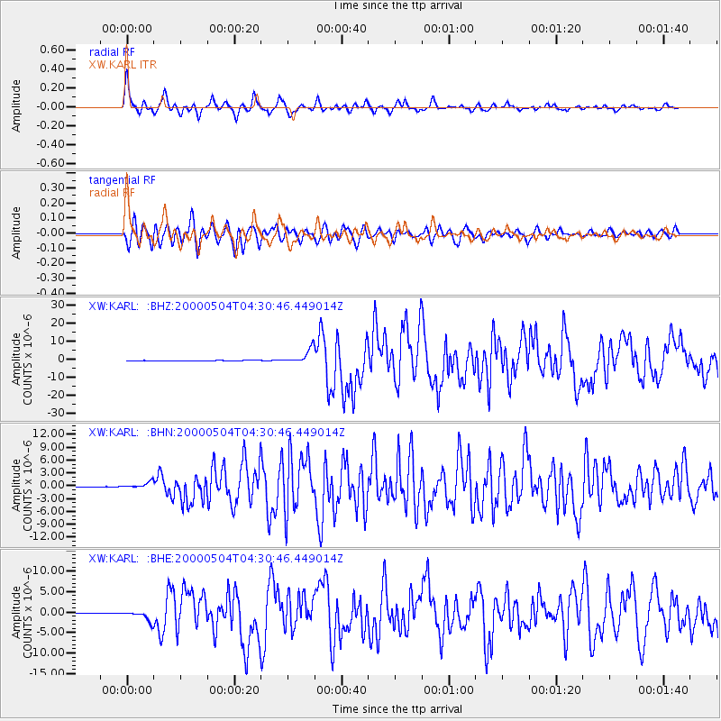
Earthquake location: Sulawesi, Indonesia
Earthquake latitude/longitude: -1.1/123.6
Earthquake time(UTC): 2000/05/04 (125) 04:21:16 GMT
Earthquake Depth: 26 km
Earthquake Magnitude: 6.7 MB, 7.5 MS, 7.6 MW, 7.5 ME
Earthquake Catalog/Contributor: WHDF/NEIC
Network: XW Tien Shan Continental Dynamics
Station: KARL XW.KARL
Lat/Lon: 41.47 N/77.31 E
Elevation: 3021 m
Distance: 59.6 deg
Az: 320.963 deg
Baz: 123.073 deg
Ray Param: 0.06207533
Estimated Moho Depth: 59.25 km
Estimated Crust Vp/Vs: 1.73
Assumed Crust Vp: 6.491 km/s
Estimated Crust Vs: 3.757 km/s
Estimated Crust Poisson's Ratio: 0.25
Radial Match: 90.83298 %
Radial Bump: 400
Transverse Match: 81.54762 %
Transverse Bump: 400
SOD ConfigId: 20082
Insert Time: 2010-02-26 15:27:11.829 +0000
GWidth: 2.5
Max Bumps: 400
Tol: 0.001

Signal To Noise

ChannelStoNSTALTA
XW:KARL: :BHN:20000504T04:30:46.449014Z18.0925467.211195E-73.985727E-8
XW:KARL: :BHE:20000504T04:30:46.449014Z48.6106531.2988243E-62.671892E-8
XW:KARL: :BHZ:20000504T04:30:46.449014Z61.7756844.1598837E-66.733853E-8
Arrivals
Ps7.0 SECOND
PpPs24 SECOND
PsPs/PpSs31 SECOND