KARL XW.KARL - Earthquake Result Viewer
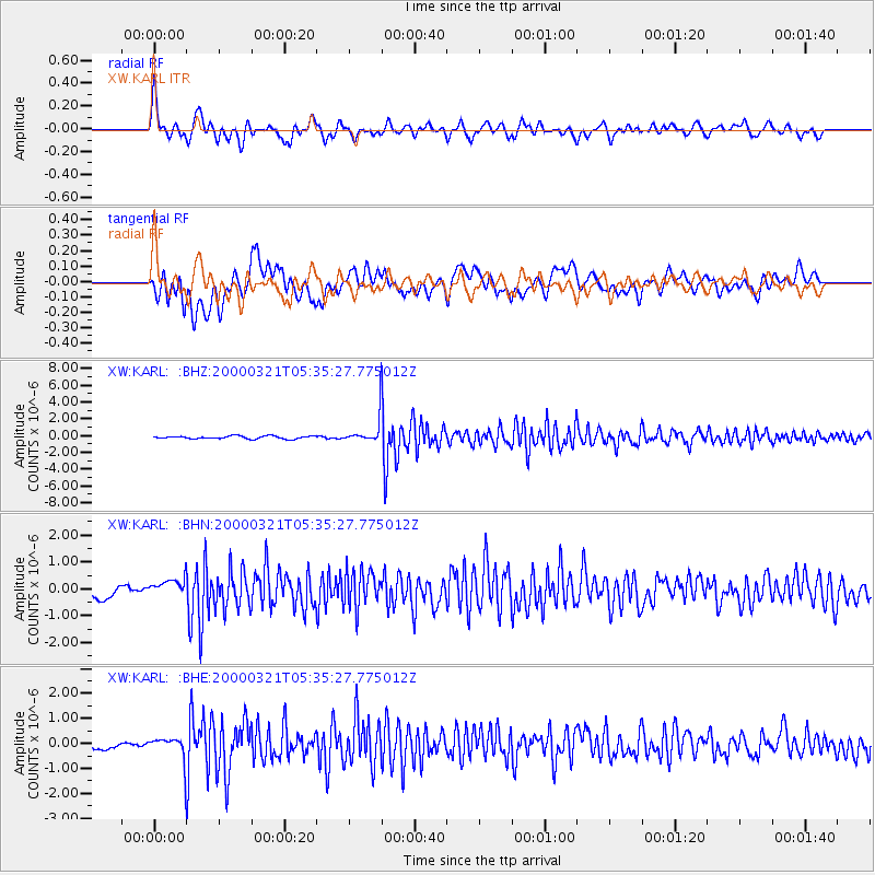
Earthquake location: North Of Halmahera, Indonesia
Earthquake latitude/longitude: 3.2/128.0
Earthquake time(UTC): 2000/03/21 (081) 05:26:07 GMT
Earthquake Depth: 103 km
Earthquake Magnitude: 6.1 MB, 5.3 MS, 6.0 MW, 5.9 MW
Earthquake Catalog/Contributor: WHDF/NEIC
Network: XW Tien Shan Continental Dynamics
Station: KARL XW.KARL
Lat/Lon: 41.47 N/77.31 E
Elevation: 3021 m
Distance: 59.3 deg
Az: 317.407 deg
Baz: 115.938 deg
Ray Param: 0.062003534
Estimated Moho Depth: 62.5 km
Estimated Crust Vp/Vs: 1.65
Assumed Crust Vp: 6.491 km/s
Estimated Crust Vs: 3.934 km/s
Estimated Crust Poisson's Ratio: 0.21
Radial Match: 90.05722 %
Radial Bump: 400
Transverse Match: 76.263336 %
Transverse Bump: 400
SOD ConfigId: 20082
Insert Time: 2010-02-26 15:27:21.161 +0000
GWidth: 2.5
Max Bumps: 400
Tol: 0.001

Signal To Noise

ChannelStoNSTALTA
XW:KARL: :BHN:20000321T05:35:27.775012Z1.62879033.4009372E-72.0880141E-7
XW:KARL: :BHE:20000321T05:35:27.775012Z3.5457424.5024666E-71.2698236E-7
XW:KARL: :BHZ:20000321T05:35:27.775012Z9.7150141.5848184E-61.6313084E-7
Arrivals
Ps6.6 SECOND
PpPs24 SECOND
PsPs/PpSs31 SECOND