KARL XW.KARL - Earthquake Result Viewer
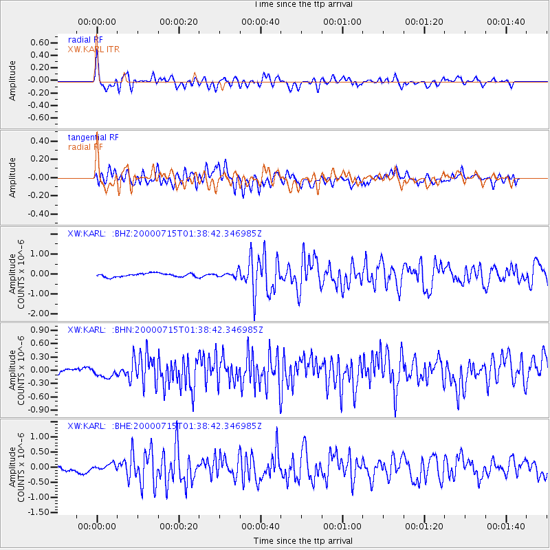
Earthquake location: Near S. Coast Of Honshu, Japan
Earthquake latitude/longitude: 34.3/139.3
Earthquake time(UTC): 2000/07/15 (197) 01:30:30 GMT
Earthquake Depth: 10 km
Earthquake Magnitude: 5.5 MB, 5.9 MS, 6.1 MW, 6.0 MW
Earthquake Catalog/Contributor: WHDF/NEIC
Network: XW Tien Shan Continental Dynamics
Station: KARL XW.KARL
Lat/Lon: 41.47 N/77.31 E
Elevation: 3021 m
Distance: 48.5 deg
Az: 297.671 deg
Baz: 77.275 deg
Ray Param: 0.0693271
Estimated Moho Depth: 40.25 km
Estimated Crust Vp/Vs: 2.08
Assumed Crust Vp: 6.491 km/s
Estimated Crust Vs: 3.117 km/s
Estimated Crust Poisson's Ratio: 0.35
Radial Match: 83.429306 %
Radial Bump: 400
Transverse Match: 73.28831 %
Transverse Bump: 400
SOD ConfigId: 3744
Insert Time: 2010-02-26 15:27:28.529 +0000
GWidth: 2.5
Max Bumps: 400
Tol: 0.001

Signal To Noise

ChannelStoNSTALTA
XW:KARL: :BHN:20000715T01:38:42.346985Z1.08569251.241229E-71.1432601E-7
XW:KARL: :BHE:20000715T01:38:42.346985Z1.04683521.0085929E-79.634687E-8
XW:KARL: :BHZ:20000715T01:38:42.346985Z1.66004651.4781371E-78.904191E-8
Arrivals
Ps7.1 SECOND
PpPs18 SECOND
PsPs/PpSs25 SECOND