KARL XW.KARL - Earthquake Result Viewer
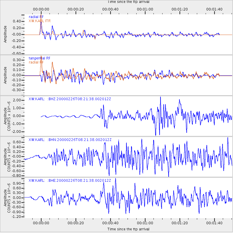
Earthquake location: Mariana Islands
Earthquake latitude/longitude: 13.8/144.8
Earthquake time(UTC): 2000/02/26 (057) 08:11:48 GMT
Earthquake Depth: 132 km
Earthquake Magnitude: 6.0 MB, 5.4 MS, 6.2 MW, 6.2 MW
Earthquake Catalog/Contributor: WHDF/NEIC
Network: XW Tien Shan Continental Dynamics
Station: KARL XW.KARL
Lat/Lon: 41.47 N/77.31 E
Elevation: 3021 m
Distance: 64.1 deg
Az: 309.528 deg
Baz: 94.303 deg
Ray Param: 0.058740593
Estimated Moho Depth: 53.0 km
Estimated Crust Vp/Vs: 1.77
Assumed Crust Vp: 6.491 km/s
Estimated Crust Vs: 3.667 km/s
Estimated Crust Poisson's Ratio: 0.27
Radial Match: 83.99411 %
Radial Bump: 400
Transverse Match: 82.39527 %
Transverse Bump: 400
SOD ConfigId: 20082
Insert Time: 2010-02-26 15:27:33.362 +0000
GWidth: 2.5
Max Bumps: 400
Tol: 0.001

Signal To Noise

ChannelStoNSTALTA
XW:KARL: :BHN:20000226T08:21:38.002012Z1.05641045.1487476E-84.8738137E-8
XW:KARL: :BHE:20000226T08:21:38.002012Z2.29016021.745058E-77.619807E-8
XW:KARL: :BHZ:20000226T08:21:38.002012Z3.60510373.002988E-78.329825E-8
Arrivals
Ps6.6 SECOND
PpPs22 SECOND
PsPs/PpSs28 SECOND