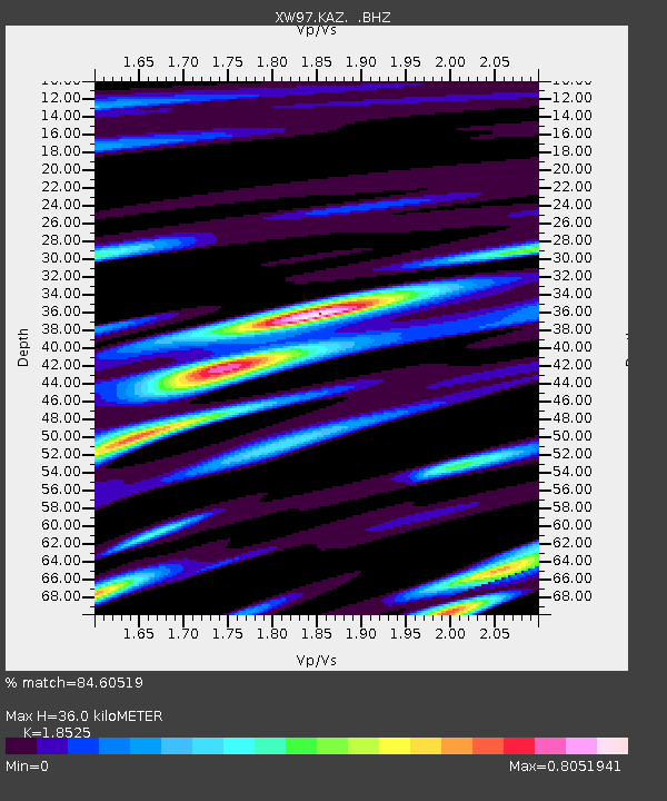
KAZ XW.KAZ - Earthquake Result Viewer
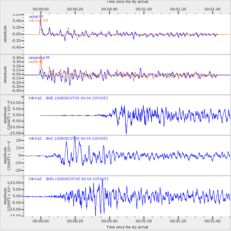
Earthquake location: Bonin Islands, Japan Region
Earthquake latitude/longitude: 28.9/139.3
Earthquake time(UTC): 1998/08/20 (232) 06:40:55 GMT
Earthquake Depth: 441 km
Earthquake Magnitude: 6.1 MB, 7.0 UNKNOWN, 7.0 MW
Earthquake Catalog/Contributor: WHDF/NEIC
Network: XW Tien Shan Continental Dynamics
Station: KAZ XW.KAZ
Lat/Lon: 41.38 N/73.94 E
Elevation: 1404 m
Distance: 53.7 deg
Az: 301.939 deg
Baz: 81.317 deg
Ray Param: 0.06413897
Estimated Moho Depth: 36.0 km
Estimated Crust Vp/Vs: 1.85
Assumed Crust Vp: 6.306 km/s
Estimated Crust Vs: 3.404 km/s
Estimated Crust Poisson's Ratio: 0.29
Radial Match: 84.60519 %
Radial Bump: 400
Transverse Match: 75.47678 %
Transverse Bump: 400
SOD ConfigId: 4480
Insert Time: 2010-02-26 15:28:41.163 +0000
GWidth: 2.5
Max Bumps: 400
Tol: 0.001

Signal To Noise

ChannelStoNSTALTA
XW:KAZ: :BHZ:19980820T06:49:04.305005Z13.7688626.3135474E-74.585381E-8
XW:KAZ: :BHN:19980820T06:49:04.305005Z2.42977268.0930654E-83.3307913E-8
XW:KAZ: :BHE:19980820T06:49:04.305005Z6.66180662.872231E-74.3114895E-8
Arrivals
Ps5.1 SECOND
PpPs16 SECOND
PsPs/PpSs21 SECOND