
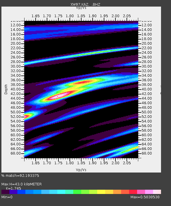
KAZ XW.KAZ - Earthquake Result Viewer
| ||||||||||||||||||
| ||||||||||||||||||
| ||||||||||||||||||
|
Signal To Noise
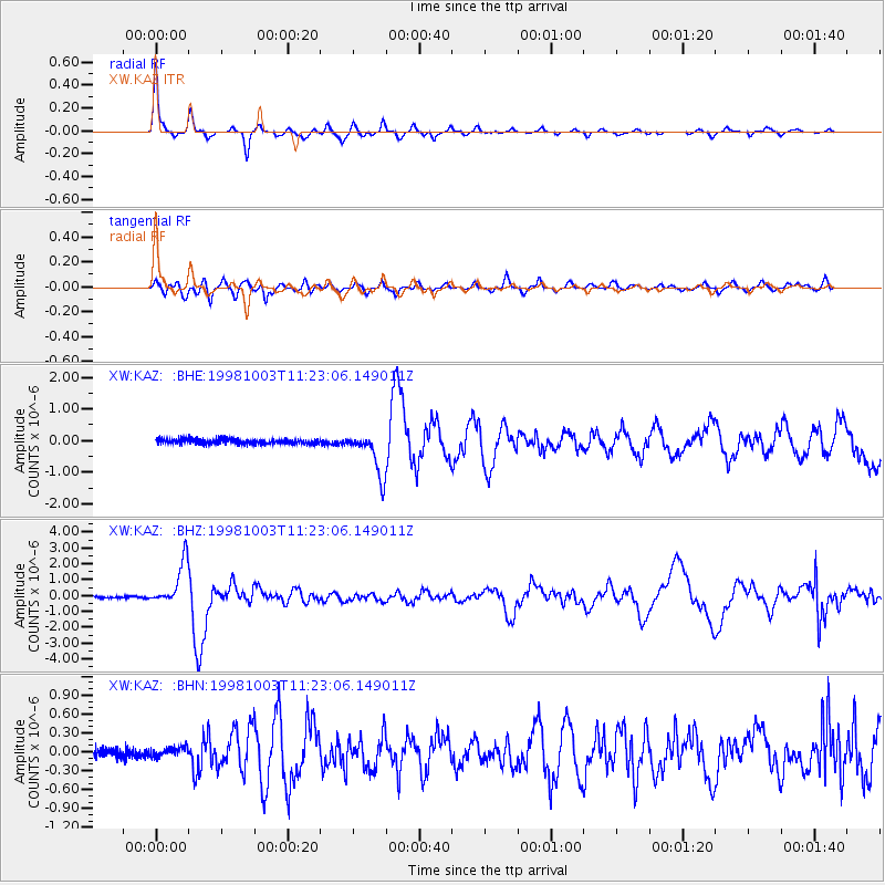
| Channel | StoN | STA | LTA |
| XW:KAZ: :BHZ:19981003T11:23:06.149011Z | 23.170492 | 1.3849044E-6 | 5.977017E-8 |
| XW:KAZ: :BHN:19981003T11:23:06.149011Z | 0.8834361 | 7.711399E-8 | 8.7288704E-8 |
| XW:KAZ: :BHE:19981003T11:23:06.149011Z | 9.086732 | 6.9727196E-7 | 7.673517E-8 |
| Arrivals | |
| Ps | 5.4 SECOND |
| PpPs | 18 SECOND |
| PsPs/PpSs | 23 SECOND |

