KAZ XW.KAZ - Earthquake Result Viewer
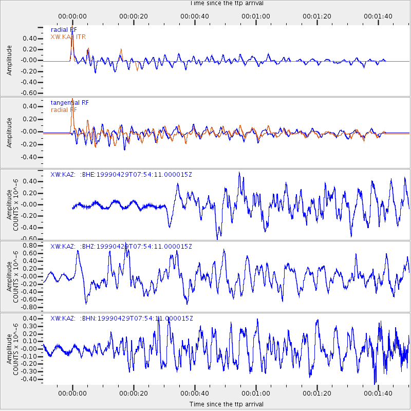
Earthquake location: Southeast Of Ryukyu Islands
Earthquake latitude/longitude: 28.9/131.1
Earthquake time(UTC): 1999/04/29 (119) 07:46:08 GMT
Earthquake Depth: 33 km
Earthquake Magnitude: 5.8 MB, 5.5 MS, 5.9 MW, 5.9 MW
Earthquake Catalog/Contributor: WHDF/NEIC
Network: XW Tien Shan Continental Dynamics
Station: KAZ XW.KAZ
Lat/Lon: 41.38 N/73.94 E
Elevation: 1404 m
Distance: 47.6 deg
Az: 301.123 deg
Baz: 86.235 deg
Ray Param: 0.06979928
Estimated Moho Depth: 37.25 km
Estimated Crust Vp/Vs: 1.78
Assumed Crust Vp: 6.306 km/s
Estimated Crust Vs: 3.543 km/s
Estimated Crust Poisson's Ratio: 0.27
Radial Match: 91.29321 %
Radial Bump: 400
Transverse Match: 84.26576 %
Transverse Bump: 400
SOD ConfigId: 4480
Insert Time: 2010-02-26 15:30:08.439 +0000
GWidth: 2.5
Max Bumps: 400
Tol: 0.001

Signal To Noise

ChannelStoNSTALTA
XW:KAZ: :BHZ:19990429T07:54:11.000015Z4.82692583.7643704E-77.798691E-8
XW:KAZ: :BHN:19990429T07:54:11.000015Z0.79099484.232314E-85.3506216E-8
XW:KAZ: :BHE:19990429T07:54:11.000015Z4.81024742.0680764E-74.299314E-8
Arrivals
Ps4.9 SECOND
PpPs15 SECOND
PsPs/PpSs20 SECOND