KAZ XW.KAZ - Earthquake Result Viewer
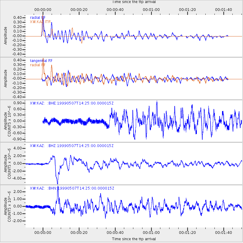
Earthquake location: Kodiak Island Region, Alaska
Earthquake latitude/longitude: 56.4/-152.9
Earthquake time(UTC): 1999/05/07 (127) 14:13:52 GMT
Earthquake Depth: 20 km
Earthquake Magnitude: 5.7 MB, 6.1 MS, 6.4 MW, 5.7 ME
Earthquake Catalog/Contributor: WHDF/NEIC
Network: XW Tien Shan Continental Dynamics
Station: KAZ XW.KAZ
Lat/Lon: 41.38 N/73.94 E
Elevation: 1404 m
Distance: 74.8 deg
Az: 325.311 deg
Baz: 24.854 deg
Ray Param: 0.052051987
Estimated Moho Depth: 12.5 km
Estimated Crust Vp/Vs: 1.61
Assumed Crust Vp: 6.306 km/s
Estimated Crust Vs: 3.917 km/s
Estimated Crust Poisson's Ratio: 0.19
Radial Match: 92.91547 %
Radial Bump: 400
Transverse Match: 82.17649 %
Transverse Bump: 400
SOD ConfigId: 4480
Insert Time: 2010-02-26 15:30:09.841 +0000
GWidth: 2.5
Max Bumps: 400
Tol: 0.001

Signal To Noise

ChannelStoNSTALTA
XW:KAZ: :BHZ:19990507T14:25:00.000015Z7.36067775.579308E-77.579883E-8
XW:KAZ: :BHN:19990507T14:25:00.000015Z1.68927491.9105624E-71.1309955E-7
XW:KAZ: :BHE:19990507T14:25:00.000015Z0.914837668.213372E-88.9779554E-8
Arrivals
Ps1.3 SECOND
PpPs5.0 SECOND
PsPs/PpSs6.2 SECOND