
FA17 fled station 17 - Earthquake Result Viewer
| ||||||||||||||||||
| ||||||||||||||||||
| ||||||||||||||||||
|
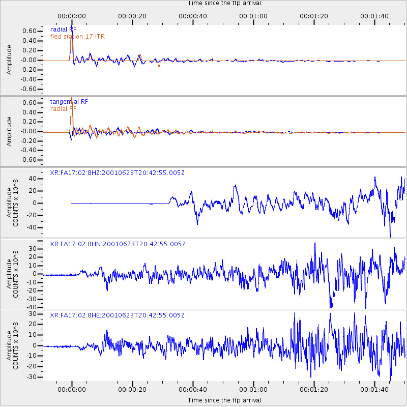
Signal To Noise
| Channel | StoN | STA | LTA |
| XR:FA17:02:BHN:20010623T20:42:55.005Z | 6.9881377 | 2360.9553 | 337.85187 |
| XR:FA17:02:BHE:20010623T20:42:55.005Z | 5.6716504 | 1502.843 | 264.97458 |
| XR:FA17:02:BHZ:20010623T20:42:55.005Z | 26.490395 | 5235.914 | 197.6533 |
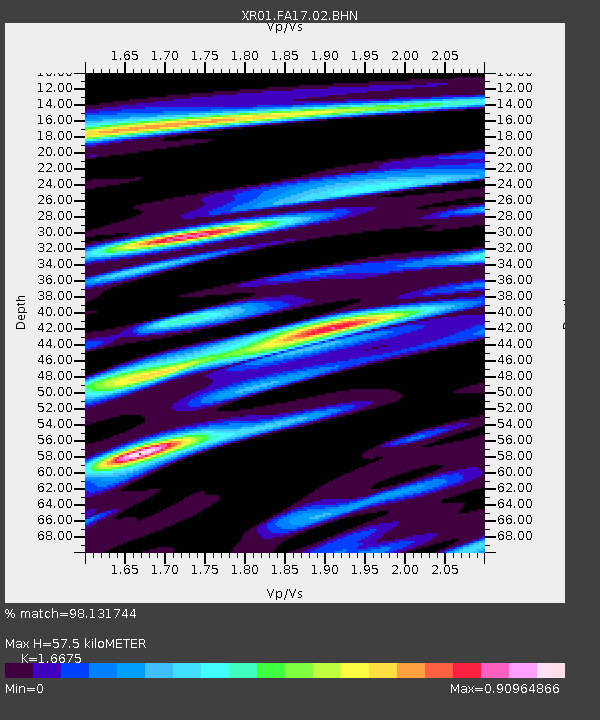
| Arrivals | |
| Ps | 6.2 SECOND |
| PpPs | 22 SECOND |
| PsPs/PpSs | 29 SECOND |

