FA17 fled station 17 - Earthquake Result Viewer
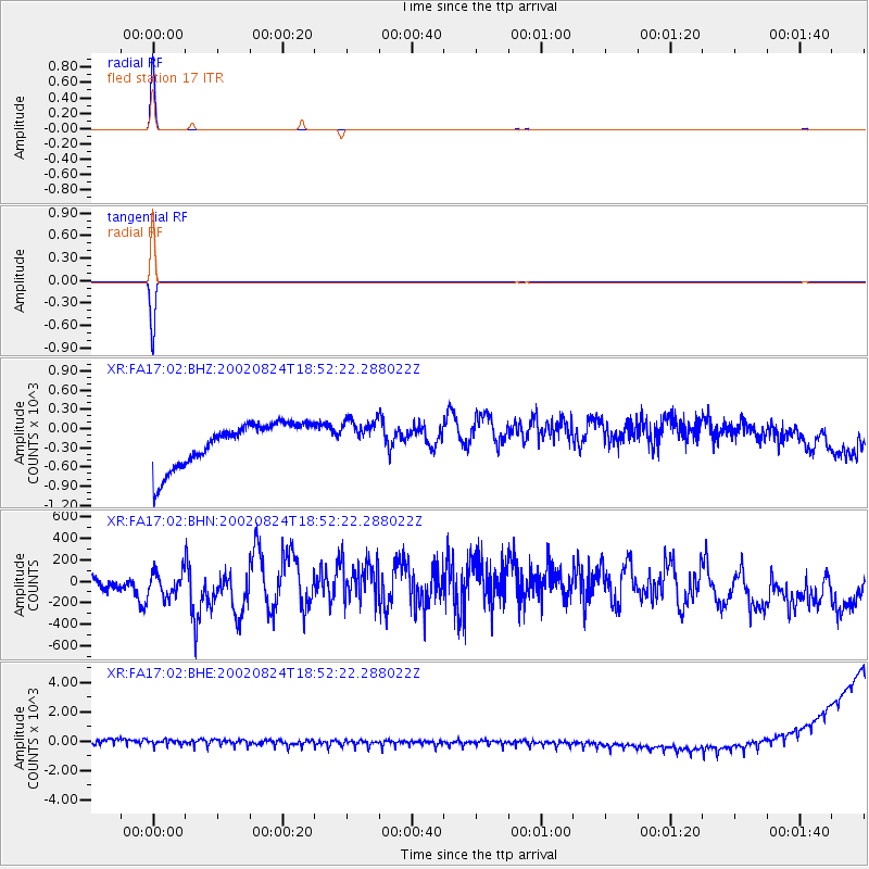
Earthquake location: Kuril Islands
Earthquake latitude/longitude: 43.1/146.1
Earthquake time(UTC): 2002/08/24 (236) 18:40:53 GMT
Earthquake Depth: 43 km
Earthquake Magnitude: 5.9 MB, 5.8 MS, 6.2 MW, 6.1 MW
Earthquake Catalog/Contributor: WHDF/NEIC
Network: XR Florida to Edmonton Seismic Experiment
Station: FA17 fled station 17
Lat/Lon: 42.03 N/94.84 W
Elevation: 361 m
Distance: 79.1 deg
Az: 41.551 deg
Baz: 319.305 deg
Ray Param: 0.049134422
Estimated Moho Depth: 69.75 km
Estimated Crust Vp/Vs: 2.10
Assumed Crust Vp: 6.53 km/s
Estimated Crust Vs: 3.113 km/s
Estimated Crust Poisson's Ratio: 0.35
Radial Match: 99.851036 %
Radial Bump: 41
Transverse Match: 99.98508 %
Transverse Bump: 2
SOD ConfigId: 248956
Insert Time: 2010-03-09 08:12:33.194 +0000
GWidth: 2.5
Max Bumps: 400
Tol: 0.001

Signal To Noise

ChannelStoNSTALTA
XR:FA17:02:BHN:20020824T18:52:22.288022Z1.418692229.43204161.72083
XR:FA17:02:BHE:20020824T18:52:22.288022Z0.9234021430.84464466.58398
XR:FA17:02:BHZ:20020824T18:52:22.288022Z0.8328974280.17206336.38242
Arrivals
Ps12 SECOND
PpPs32 SECOND
PsPs/PpSs44 SECOND