
FA21 fled station 21 - Earthquake Result Viewer
| ||||||||||||||||||
| ||||||||||||||||||
| ||||||||||||||||||
|
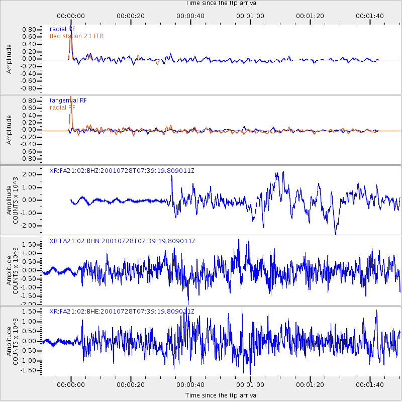
Signal To Noise
| Channel | StoN | STA | LTA |
| XR:FA21:02:BHN:20010728T07:39:19.809011Z | 2.1281745 | 251.59917 | 118.22299 |
| XR:FA21:02:BHE:20010728T07:39:19.809011Z | 3.8682134 | 331.1341 | 85.60389 |
| XR:FA21:02:BHZ:20010728T07:39:19.809011Z | 4.0620503 | 501.1457 | 123.3726 |
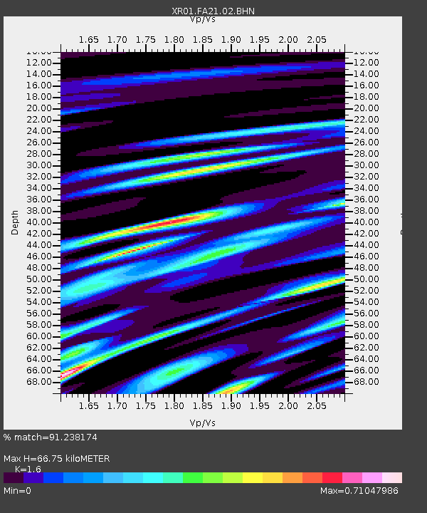
| Arrivals | |
| Ps | 6.7 SECOND |
| PpPs | 25 SECOND |
| PsPs/PpSs | 31 SECOND |

