You are here: Home > Network List > IC - New China Digital Seismograph Network Stations List
> Station HIA Hailar, Neimenggu Autonomous Region, China > Earthquake Result Viewer
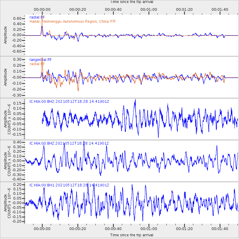
HIA Hailar, Neimenggu Autonomous Region, China - Earthquake Result Viewer
*The percent match for this event was below the threshold and hence no stack was calculated.
| Earthquake location: |
North Of Halmahera, Indonesia |
| Earthquake latitude/longitude: |
3.9/128.6 |
| Earthquake time(UTC): |
2021/05/12 (132) 18:20:29 GMT |
| Earthquake Depth: |
60 km |
| Earthquake Magnitude: |
5.5 mww |
| Earthquake Catalog/Contributor: |
NEIC PDE/us |
|
| Network: |
IC New China Digital Seismograph Network |
| Station: |
HIA Hailar, Neimenggu Autonomous Region, China |
| Lat/Lon: |
49.27 N/119.74 E |
| Elevation: |
620 m |
|
| Distance: |
45.8 deg |
| Az: |
351.884 deg |
| Baz: |
167.582 deg |
| Ray Param: |
$rayparam |
*The percent match for this event was below the threshold and hence was not used in the summary stack. |
|
| Radial Match: |
61.500175 % |
| Radial Bump: |
400 |
| Transverse Match: |
61.10162 % |
| Transverse Bump: |
400 |
| SOD ConfigId: |
25028951 |
| Insert Time: |
2021-06-03 01:05:24.462 +0000 |
| GWidth: |
2.5 |
| Max Bumps: |
400 |
| Tol: |
0.001 |
|
Signal To Noise
| Channel | StoN | STA | LTA |
| IC:HIA:00:BHZ:20210512T18:28:14.41901Z | 2.5031106 | 1.3644036E-7 | 5.4508323E-8 |
| IC:HIA:00:BH1:20210512T18:28:14.41901Z | 2.3939035 | 6.751771E-8 | 2.8204024E-8 |
| IC:HIA:00:BH2:20210512T18:28:14.41901Z | 0.810211 | 3.4021685E-8 | 4.1991143E-8 |
| Arrivals |
| Ps | |
| PpPs | |
| PsPs/PpSs | |


