KOPG XW.KOPG - Earthquake Result Viewer
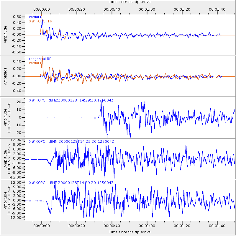
Earthquake location: Kuril Islands
Earthquake latitude/longitude: 43.0/146.8
Earthquake time(UTC): 2000/01/28 (028) 14:21:07 GMT
Earthquake Depth: 61 km
Earthquake Magnitude: 6.7 MB, 6.6 MS, 6.8 MW, 6.8 ME
Earthquake Catalog/Contributor: WHDF/NEIC
Network: XW Tien Shan Continental Dynamics
Station: KOPG XW.KOPG
Lat/Lon: 40.50 N/79.04 E
Elevation: 1114 m
Distance: 49.4 deg
Az: 291.518 deg
Baz: 63.433 deg
Ray Param: 0.06857786
Estimated Moho Depth: 38.75 km
Estimated Crust Vp/Vs: 1.99
Assumed Crust Vp: 6.353 km/s
Estimated Crust Vs: 3.201 km/s
Estimated Crust Poisson's Ratio: 0.33
Radial Match: 91.613335 %
Radial Bump: 400
Transverse Match: 87.06839 %
Transverse Bump: 400
SOD ConfigId: 20082
Insert Time: 2010-02-26 15:36:50.434 +0000
GWidth: 2.5
Max Bumps: 400
Tol: 0.001

Signal To Noise

ChannelStoNSTALTA
XW:KOPG: :BHN:20000128T14:29:20.125004Z9.8294721.1785945E-61.1990416E-7
XW:KOPG: :BHE:20000128T14:29:20.125004Z32.2066422.9821842E-69.2595315E-8
XW:KOPG: :BHZ:20000128T14:29:20.125004Z91.6238.088999E-68.8285674E-8
Arrivals
Ps6.3 SECOND
PpPs17 SECOND
PsPs/PpSs24 SECOND