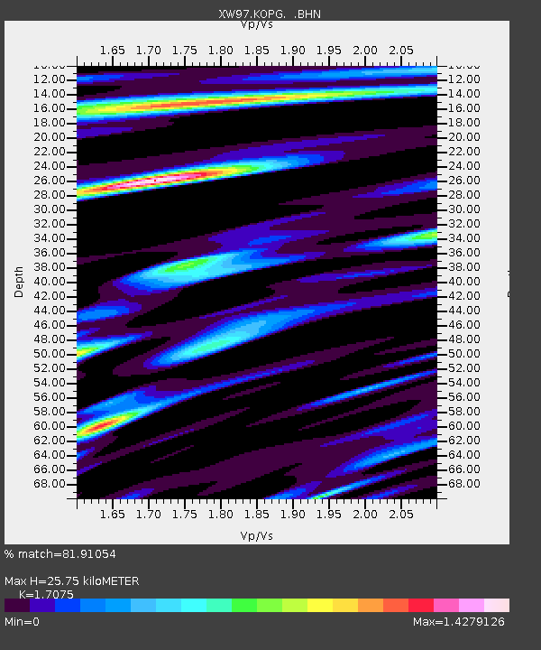
KOPG XW.KOPG - Earthquake Result Viewer
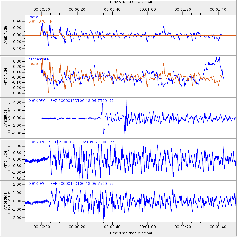
Earthquake location: Flores Sea
Earthquake latitude/longitude: -8.0/120.6
Earthquake time(UTC): 2000/01/23 (023) 06:08:24 GMT
Earthquake Depth: 47 km
Earthquake Magnitude: 5.7 MB, 5.2 MS, 5.8 MW, 5.7 MW
Earthquake Catalog/Contributor: WHDF/NEIC
Network: XW Tien Shan Continental Dynamics
Station: KOPG XW.KOPG
Lat/Lon: 40.50 N/79.04 E
Elevation: 1114 m
Distance: 61.6 deg
Az: 324.876 deg
Baz: 131.638 deg
Ray Param: 0.060684696
Estimated Moho Depth: 25.75 km
Estimated Crust Vp/Vs: 1.71
Assumed Crust Vp: 6.353 km/s
Estimated Crust Vs: 3.721 km/s
Estimated Crust Poisson's Ratio: 0.24
Radial Match: 81.91054 %
Radial Bump: 400
Transverse Match: 44.95748 %
Transverse Bump: 400
SOD ConfigId: 20082
Insert Time: 2010-02-26 15:36:52.082 +0000
GWidth: 2.5
Max Bumps: 400
Tol: 0.001

Signal To Noise

ChannelStoNSTALTA
XW:KOPG: :BHN:20000123T06:18:06.750017Z1.92422243.4147325E-71.774604E-7
XW:KOPG: :BHE:20000123T06:18:06.750017Z0.825545252.32832E-72.820342E-7
XW:KOPG: :BHZ:20000123T06:18:06.750017Z17.0659431.1698394E-66.854819E-8
Arrivals
Ps3.0 SECOND
PpPs10 SECOND
PsPs/PpSs13 SECOND