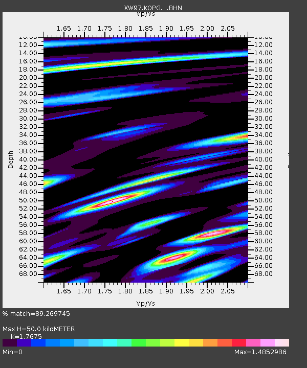
KOPG XW.KOPG - Earthquake Result Viewer

Earthquake location: Southeast Of Shikoku, Japan
Earthquake latitude/longitude: 29.4/132.1
Earthquake time(UTC): 2000/06/15 (167) 11:10:46 GMT
Earthquake Depth: 10 km
Earthquake Magnitude: 6.0 MB, 5.6 MS, 6.1 MW, 6.1 MW
Earthquake Catalog/Contributor: WHDF/NEIC
Network: XW Tien Shan Continental Dynamics
Station: KOPG XW.KOPG
Lat/Lon: 40.50 N/79.04 E
Elevation: 1114 m
Distance: 44.3 deg
Az: 299.238 deg
Baz: 87.329 deg
Ray Param: 0.07200714
Estimated Moho Depth: 50.0 km
Estimated Crust Vp/Vs: 1.77
Assumed Crust Vp: 6.353 km/s
Estimated Crust Vs: 3.594 km/s
Estimated Crust Poisson's Ratio: 0.26
Radial Match: 89.269745 %
Radial Bump: 400
Transverse Match: 74.38408 %
Transverse Bump: 400
SOD ConfigId: 3744
Insert Time: 2010-02-26 15:37:00.660 +0000
GWidth: 2.5
Max Bumps: 400
Tol: 0.001

Signal To Noise

ChannelStoNSTALTA
XW:KOPG: :BHN:20000615T11:18:25.121011Z2.17794564.400385E-72.0204294E-7
XW:KOPG: :BHE:20000615T11:18:25.121011Z0.899480461.2111813E-71.3465343E-7
XW:KOPG: :BHZ:20000615T11:18:25.121011Z2.77031973.9252848E-71.4169068E-7
Arrivals
Ps6.4 SECOND
PpPs20 SECOND
PsPs/PpSs27 SECOND