You are here: Home > Network List > IC - New China Digital Seismograph Network Stations List
> Station HIA Hailar, Neimenggu Autonomous Region, China > Earthquake Result Viewer
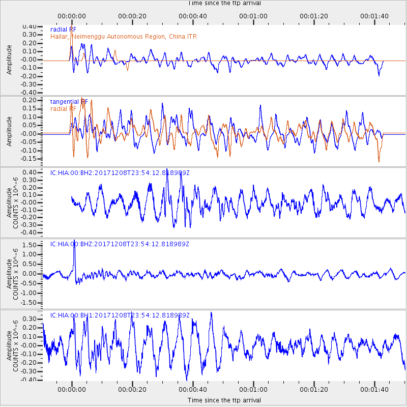
HIA Hailar, Neimenggu Autonomous Region, China - Earthquake Result Viewer
*The percent match for this event was below the threshold and hence no stack was calculated.
| Earthquake location: |
Tonga Islands |
| Earthquake latitude/longitude: |
-16.1/-174.0 |
| Earthquake time(UTC): |
2017/12/08 (342) 23:42:09 GMT |
| Earthquake Depth: |
117 km |
| Earthquake Magnitude: |
5.7 mb |
| Earthquake Catalog/Contributor: |
NEIC PDE/us |
|
| Network: |
IC New China Digital Seismograph Network |
| Station: |
HIA Hailar, Neimenggu Autonomous Region, China |
| Lat/Lon: |
49.27 N/119.74 E |
| Elevation: |
620 m |
|
| Distance: |
87.5 deg |
| Az: |
323.104 deg |
| Baz: |
118.242 deg |
| Ray Param: |
$rayparam |
*The percent match for this event was below the threshold and hence was not used in the summary stack. |
|
| Radial Match: |
46.536987 % |
| Radial Bump: |
379 |
| Transverse Match: |
49.31884 % |
| Transverse Bump: |
377 |
| SOD ConfigId: |
2429771 |
| Insert Time: |
2017-12-22 23:44:01.544 +0000 |
| GWidth: |
2.5 |
| Max Bumps: |
400 |
| Tol: |
0.001 |
|
Signal To Noise
| Channel | StoN | STA | LTA |
| IC:HIA:00:BHZ:20171208T23:54:12.818989Z | 6.500976 | 5.143193E-7 | 7.911417E-8 |
| IC:HIA:00:BH1:20171208T23:54:12.818989Z | 1.8184917 | 1.8488647E-7 | 1.0167023E-7 |
| IC:HIA:00:BH2:20171208T23:54:12.818989Z | 1.9701067 | 1.9863374E-7 | 1.00823854E-7 |
| Arrivals |
| Ps | |
| PpPs | |
| PsPs/PpSs | |


