You are here: Home > Network List > IC - New China Digital Seismograph Network Stations List
> Station HIA Hailar, Neimenggu Autonomous Region, China > Earthquake Result Viewer
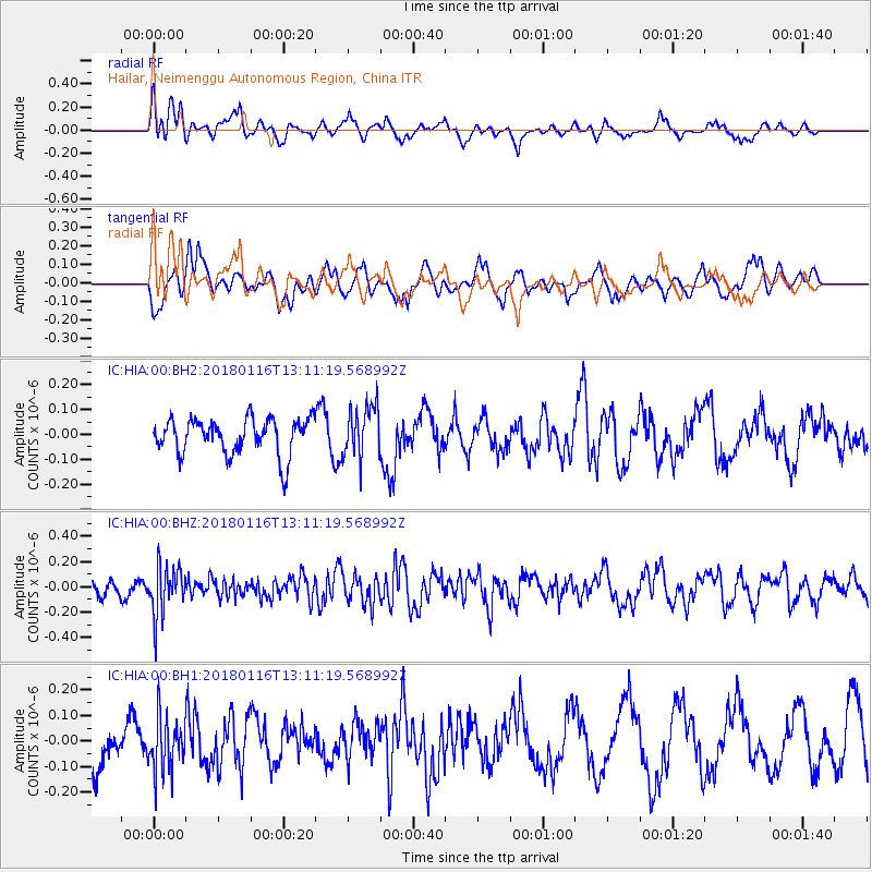
HIA Hailar, Neimenggu Autonomous Region, China - Earthquake Result Viewer
*The percent match for this event was below the threshold and hence no stack was calculated.
| Earthquake location: |
Near N Coast Of New Guinea, P.N.G. |
| Earthquake latitude/longitude: |
-4.7/144.1 |
| Earthquake time(UTC): |
2018/01/16 (016) 13:02:07 GMT |
| Earthquake Depth: |
76 km |
| Earthquake Magnitude: |
5.3 Mww |
| Earthquake Catalog/Contributor: |
NEIC PDE/us |
|
| Network: |
IC New China Digital Seismograph Network |
| Station: |
HIA Hailar, Neimenggu Autonomous Region, China |
| Lat/Lon: |
49.27 N/119.74 E |
| Elevation: |
620 m |
|
| Distance: |
57.7 deg |
| Az: |
341.395 deg |
| Baz: |
150.955 deg |
| Ray Param: |
$rayparam |
*The percent match for this event was below the threshold and hence was not used in the summary stack. |
|
| Radial Match: |
45.256184 % |
| Radial Bump: |
400 |
| Transverse Match: |
49.111965 % |
| Transverse Bump: |
400 |
| SOD ConfigId: |
2543731 |
| Insert Time: |
2018-01-30 13:02:50.113 +0000 |
| GWidth: |
2.5 |
| Max Bumps: |
400 |
| Tol: |
0.001 |
|
Signal To Noise
| Channel | StoN | STA | LTA |
| IC:HIA:00:BHZ:20180116T13:11:19.568992Z | 3.4294965 | 1.9739383E-7 | 5.7557667E-8 |
| IC:HIA:00:BH1:20180116T13:11:19.568992Z | 1.360602 | 1.05606695E-7 | 7.761762E-8 |
| IC:HIA:00:BH2:20180116T13:11:19.568992Z | 1.4241017 | 1.039318E-7 | 7.2980605E-8 |
| Arrivals |
| Ps | |
| PpPs | |
| PsPs/PpSs | |


