PIQG XW.PIQG - Earthquake Result Viewer
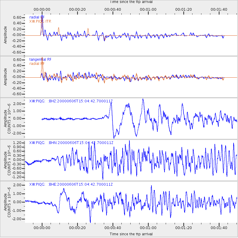
Earthquake location: Southeast Of Ryukyu Islands
Earthquake latitude/longitude: 29.4/131.4
Earthquake time(UTC): 2000/06/06 (158) 14:57:02 GMT
Earthquake Depth: 33 km
Earthquake Magnitude: 5.8 MB, 6.0 MS, 6.4 MW, 6.4 MW
Earthquake Catalog/Contributor: WHDF/NEIC
Network: XW Tien Shan Continental Dynamics
Station: PIQG XW.PIQG
Lat/Lon: 40.32 N/77.63 E
Elevation: 1736 m
Distance: 44.8 deg
Az: 298.971 deg
Baz: 86.622 deg
Ray Param: 0.07160221
Estimated Moho Depth: 58.25 km
Estimated Crust Vp/Vs: 1.85
Assumed Crust Vp: 6.491 km/s
Estimated Crust Vs: 3.509 km/s
Estimated Crust Poisson's Ratio: 0.29
Radial Match: 80.17497 %
Radial Bump: 400
Transverse Match: 67.99214 %
Transverse Bump: 400
SOD ConfigId: 16820
Insert Time: 2010-02-26 15:44:54.528 +0000
GWidth: 2.5
Max Bumps: 400
Tol: 0.001

Signal To Noise

ChannelStoNSTALTA
XW:PIQG: :BHN:20000606T15:04:42.700011Z0.3601144.496454E-81.2486196E-7
XW:PIQG: :BHE:20000606T15:04:42.700011Z0.97056691.0712677E-71.1037547E-7
XW:PIQG: :BHZ:20000606T15:04:42.700011Z1.35283247.891148E-85.8330563E-8
Arrivals
Ps8.1 SECOND
PpPs24 SECOND
PsPs/PpSs32 SECOND