You are here: Home > Network List > IC - New China Digital Seismograph Network Stations List
> Station HIA Hailar, Neimenggu Autonomous Region, China > Earthquake Result Viewer
HIA Hailar, Neimenggu Autonomous Region, China - Earthquake Result Viewer
*The percent match for this event was below the threshold and hence no stack was calculated.
| Earthquake location: |
Fiji Islands Region |
| Earthquake latitude/longitude: |
-20.6/-178.4 |
| Earthquake time(UTC): |
2021/07/17 (198) 03:23:47 GMT |
| Earthquake Depth: |
559 km |
| Earthquake Magnitude: |
5.5 Mww |
| Earthquake Catalog/Contributor: |
NEIC PDE/us |
|
| Network: |
IC New China Digital Seismograph Network |
| Station: |
HIA Hailar, Neimenggu Autonomous Region, China |
| Lat/Lon: |
49.27 N/119.74 E |
| Elevation: |
620 m |
|
| Distance: |
88.6 deg |
| Az: |
324.7 deg |
| Baz: |
124.273 deg |
| Ray Param: |
$rayparam |
*The percent match for this event was below the threshold and hence was not used in the summary stack. |
|
| Radial Match: |
61.125027 % |
| Radial Bump: |
400 |
| Transverse Match: |
52.97088 % |
| Transverse Bump: |
400 |
| SOD ConfigId: |
25131211 |
| Insert Time: |
2021-07-31 03:37:15.103 +0000 |
| GWidth: |
2.5 |
| Max Bumps: |
400 |
| Tol: |
0.001 |
|
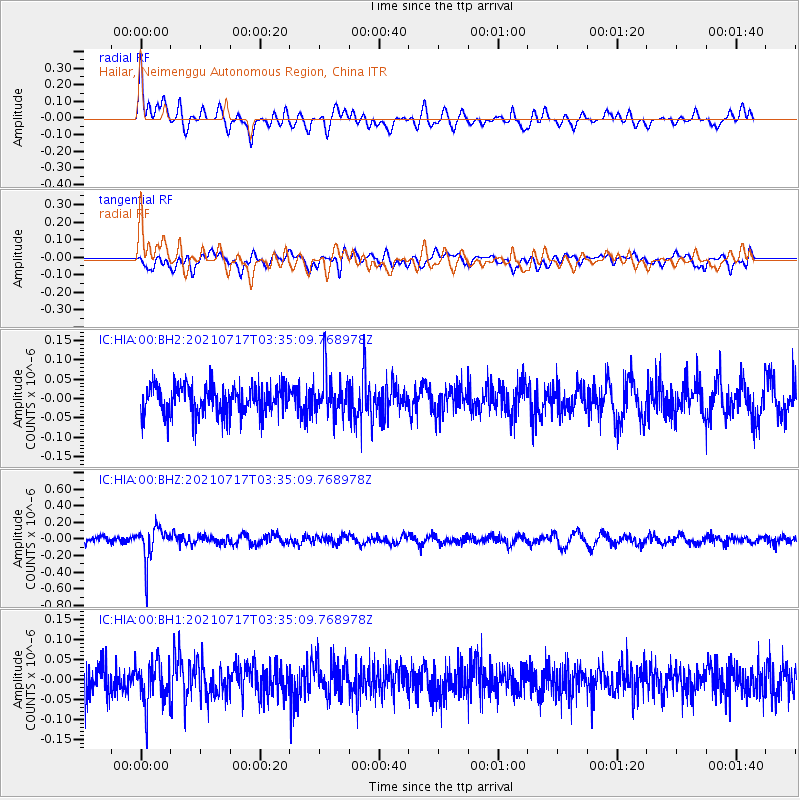
Signal To Noise
| Channel | StoN | STA | LTA |
| IC:HIA:00:BHZ:20210717T03:35:09.768978Z | 4.733001 | 2.146638E-7 | 4.535469E-8 |
| IC:HIA:00:BH1:20210717T03:35:09.768978Z | 1.6018147 | 5.3414954E-8 | 3.3346524E-8 |
| IC:HIA:00:BH2:20210717T03:35:09.768978Z | 1.4820611 | 5.6335985E-8 | 3.801192E-8 |
| Arrivals |
| Ps | |
| PpPs | |
| PsPs/PpSs | |


