TERE XW.TERE - Earthquake Result Viewer
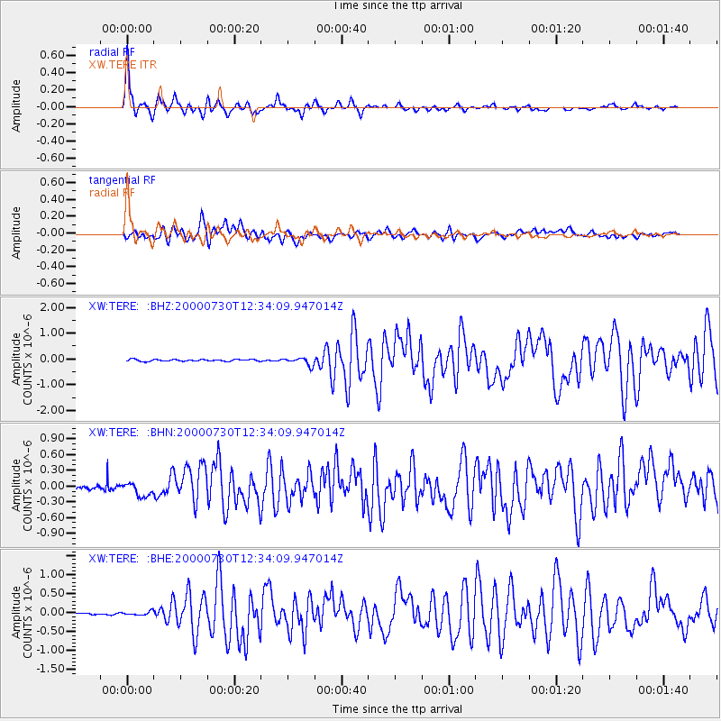
Earthquake location: Southeast Of Honshu, Japan
Earthquake latitude/longitude: 33.9/139.4
Earthquake time(UTC): 2000/07/30 (212) 12:25:45 GMT
Earthquake Depth: 10 km
Earthquake Magnitude: 6.0 MB, 6.5 MS, 6.5 MW, 6.5 MW
Earthquake Catalog/Contributor: WHDF/NEIC
Network: XW Tien Shan Continental Dynamics
Station: TERE XW.TERE
Lat/Lon: 40.48 N/75.77 E
Elevation: 3684 m
Distance: 50.1 deg
Az: 297.091 deg
Baz: 76.097 deg
Ray Param: 0.068260305
Estimated Moho Depth: 69.5 km
Estimated Crust Vp/Vs: 1.79
Assumed Crust Vp: 6.491 km/s
Estimated Crust Vs: 3.636 km/s
Estimated Crust Poisson's Ratio: 0.27
Radial Match: 94.25741 %
Radial Bump: 400
Transverse Match: 77.0458 %
Transverse Bump: 400
SOD ConfigId: 20082
Insert Time: 2010-02-26 15:46:11.473 +0000
GWidth: 2.5
Max Bumps: 400
Tol: 0.001

Signal To Noise

ChannelStoNSTALTA
XW:TERE: :BHN:20000730T12:34:09.947014Z2.89176581.2782662E-74.420366E-8
XW:TERE: :BHE:20000730T12:34:09.947014Z2.07415494.9513627E-82.3871712E-8
XW:TERE: :BHZ:20000730T12:34:09.947014Z4.211971.4808691E-73.5158585E-8
Arrivals
Ps8.9 SECOND
PpPs28 SECOND
PsPs/PpSs37 SECOND