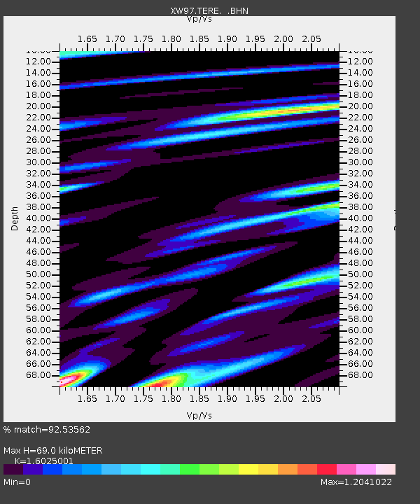
TERE XW.TERE - Earthquake Result Viewer
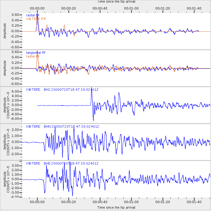
Earthquake location: Near East Coast Of Honshu, Japan
Earthquake latitude/longitude: 36.5/141.0
Earthquake time(UTC): 2000/07/20 (202) 18:39:18 GMT
Earthquake Depth: 47 km
Earthquake Magnitude: 6.1 MB, 5.4 MS, 6.1 ME, 6.0 MW
Earthquake Catalog/Contributor: WHDF/NEIC
Network: XW Tien Shan Continental Dynamics
Station: TERE XW.TERE
Lat/Lon: 40.48 N/75.77 E
Elevation: 3684 m
Distance: 50.2 deg
Az: 295.577 deg
Baz: 72.297 deg
Ray Param: 0.0681276
Estimated Moho Depth: 69.0 km
Estimated Crust Vp/Vs: 1.60
Assumed Crust Vp: 6.491 km/s
Estimated Crust Vs: 4.05 km/s
Estimated Crust Poisson's Ratio: 0.18
Radial Match: 92.53562 %
Radial Bump: 400
Transverse Match: 84.49372 %
Transverse Bump: 400
SOD ConfigId: 20082
Insert Time: 2010-02-26 15:46:12.954 +0000
GWidth: 2.5
Max Bumps: 400
Tol: 0.001

Signal To Noise

ChannelStoNSTALTA
XW:TERE: :BHN:20000720T18:47:39.02401Z11.1165213.5279947E-73.17365E-8
XW:TERE: :BHE:20000720T18:47:39.02401Z21.6719347.901281E-73.645859E-8
XW:TERE: :BHZ:20000720T18:47:39.02401Z35.3491362.0833847E-65.8937353E-8
Arrivals
Ps6.8 SECOND
PpPs26 SECOND
PsPs/PpSs33 SECOND