TERE XW.TERE - Earthquake Result Viewer
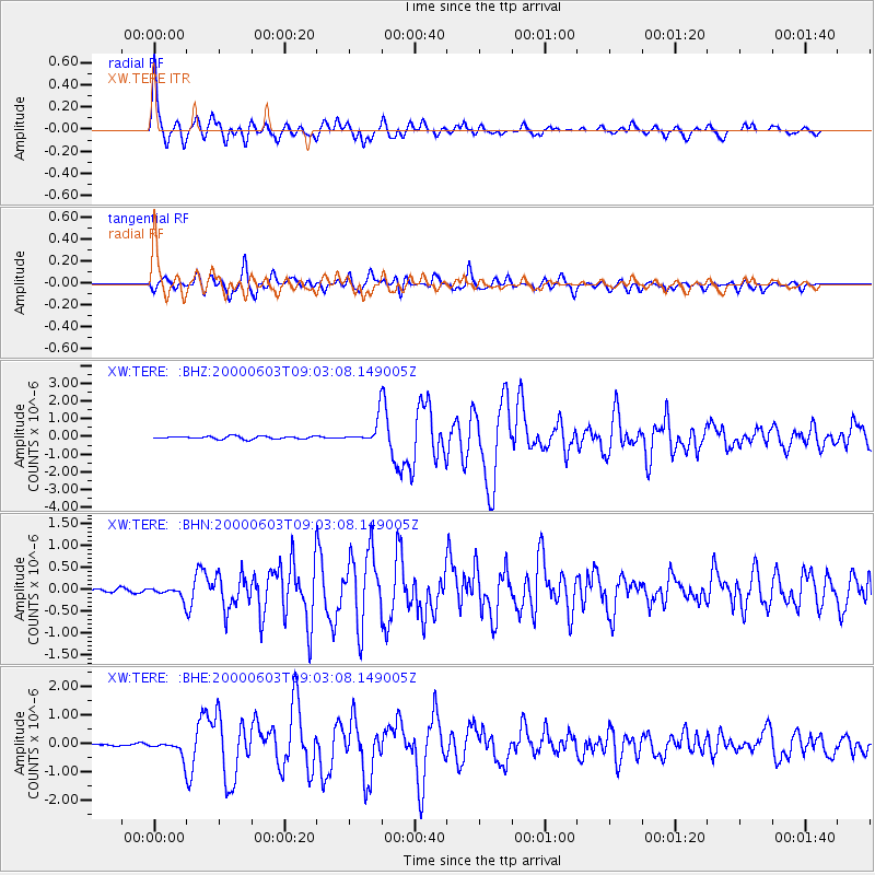
Earthquake location: Near East Coast Of Honshu, Japan
Earthquake latitude/longitude: 35.6/140.5
Earthquake time(UTC): 2000/06/03 (155) 08:54:49 GMT
Earthquake Depth: 62 km
Earthquake Magnitude: 5.6 MB, 5.6 MS, 6.1 MW, 6.1 MW
Earthquake Catalog/Contributor: WHDF/NEIC
Network: XW Tien Shan Continental Dynamics
Station: TERE XW.TERE
Lat/Lon: 40.48 N/75.77 E
Elevation: 3684 m
Distance: 50.2 deg
Az: 296.144 deg
Baz: 73.656 deg
Ray Param: 0.06804076
Estimated Moho Depth: 69.5 km
Estimated Crust Vp/Vs: 1.79
Assumed Crust Vp: 6.491 km/s
Estimated Crust Vs: 3.636 km/s
Estimated Crust Poisson's Ratio: 0.27
Radial Match: 92.808395 %
Radial Bump: 375
Transverse Match: 92.92289 %
Transverse Bump: 400
SOD ConfigId: 20082
Insert Time: 2010-02-26 15:46:46.539 +0000
GWidth: 2.5
Max Bumps: 400
Tol: 0.001

Signal To Noise

ChannelStoNSTALTA
XW:TERE: :BHN:20000603T09:03:08.149005Z2.6624321.2472749E-74.68472E-8
XW:TERE: :BHE:20000603T09:03:08.149005Z6.93423842.8391662E-74.094417E-8
XW:TERE: :BHZ:20000603T09:03:08.149005Z8.6690186.764651E-77.80325E-8
Arrivals
Ps8.9 SECOND
PpPs28 SECOND
PsPs/PpSs37 SECOND