TERE XW.TERE - Earthquake Result Viewer
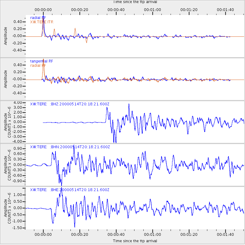
Earthquake location: Banda Sea
Earthquake latitude/longitude: -4.3/123.2
Earthquake time(UTC): 2000/05/14 (135) 20:08:34 GMT
Earthquake Depth: 33 km
Earthquake Magnitude: 5.9 MB, 5.9 MS, 6.3 MW, 6.2 MW
Earthquake Catalog/Contributor: WHDF/NEIC
Network: XW Tien Shan Continental Dynamics
Station: TERE XW.TERE
Lat/Lon: 40.48 N/75.77 E
Elevation: 3684 m
Distance: 62.2 deg
Az: 320.588 deg
Baz: 123.904 deg
Ray Param: 0.060348928
Estimated Moho Depth: 10.0 km
Estimated Crust Vp/Vs: 1.60
Assumed Crust Vp: 6.491 km/s
Estimated Crust Vs: 4.057 km/s
Estimated Crust Poisson's Ratio: 0.18
Radial Match: 97.27867 %
Radial Bump: 376
Transverse Match: 92.626915 %
Transverse Bump: 400
SOD ConfigId: 20082
Insert Time: 2010-02-26 15:46:50.739 +0000
GWidth: 2.5
Max Bumps: 400
Tol: 0.001

Signal To Noise

ChannelStoNSTALTA
XW:TERE: :BHN:20000514T20:18:21.600Z4.6656951.2044373E-72.5814746E-8
XW:TERE: :BHE:20000514T20:18:21.600Z5.10427331.4750368E-72.8898077E-8
XW:TERE: :BHZ:20000514T20:18:21.600Z13.3873746.037045E-74.5095064E-8
Arrivals
Ps1.0 SECOND
PpPs3.8 SECOND
PsPs/PpSs4.8 SECOND