TERE XW.TERE - Earthquake Result Viewer
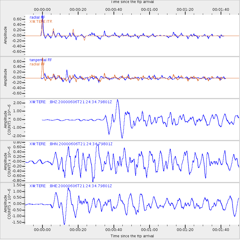
Earthquake location: Sea Of Japan
Earthquake latitude/longitude: 36.8/135.5
Earthquake time(UTC): 2000/06/06 (158) 21:16:42 GMT
Earthquake Depth: 10 km
Earthquake Magnitude: 5.7 MB, 5.3 MS, 5.9 MW, 5.8 MW
Earthquake Catalog/Contributor: WHDF/NEIC
Network: XW Tien Shan Continental Dynamics
Station: TERE XW.TERE
Lat/Lon: 40.48 N/75.77 E
Elevation: 3684 m
Distance: 46.0 deg
Az: 293.696 deg
Baz: 74.394 deg
Ray Param: 0.0709224
Estimated Moho Depth: 39.75 km
Estimated Crust Vp/Vs: 1.98
Assumed Crust Vp: 6.491 km/s
Estimated Crust Vs: 3.274 km/s
Estimated Crust Poisson's Ratio: 0.33
Radial Match: 91.43735 %
Radial Bump: 317
Transverse Match: 80.13158 %
Transverse Bump: 362
SOD ConfigId: 16820
Insert Time: 2010-02-26 15:47:14.353 +0000
GWidth: 2.5
Max Bumps: 400
Tol: 0.001

Signal To Noise

ChannelStoNSTALTA
XW:TERE: :BHN:20000606T21:24:34.79801Z1.34911223.549773E-82.631192E-8
XW:TERE: :BHE:20000606T21:24:34.79801Z1.23991383.5995523E-82.9030662E-8
XW:TERE: :BHZ:20000606T21:24:34.79801Z1.58882317.613223E-84.791737E-8
Arrivals
Ps6.4 SECOND
PpPs17 SECOND
PsPs/PpSs24 SECOND