TERE XW.TERE - Earthquake Result Viewer
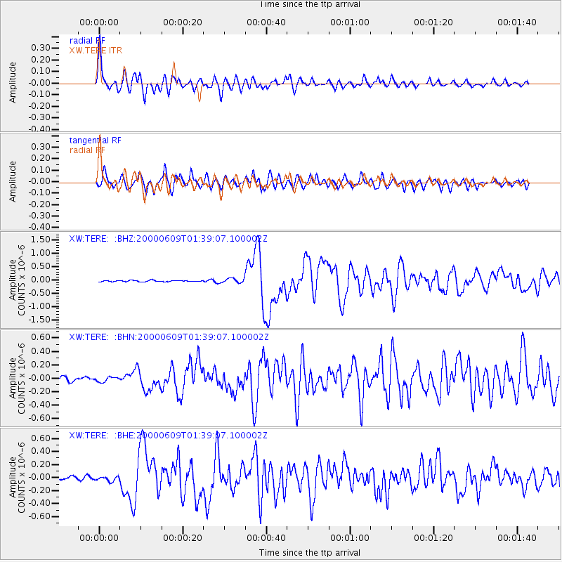
Earthquake location: New Britain Region, P.N.G.
Earthquake latitude/longitude: -5.1/152.5
Earthquake time(UTC): 2000/06/09 (161) 01:27:15 GMT
Earthquake Depth: 33 km
Earthquake Magnitude: 5.4 MB, 6.3 MS, 6.3 MW, 6.3 MW
Earthquake Catalog/Contributor: WHDF/NEIC
Network: XW Tien Shan Continental Dynamics
Station: TERE XW.TERE
Lat/Lon: 40.48 N/75.77 E
Elevation: 3684 m
Distance: 83.2 deg
Az: 311.614 deg
Baz: 102.498 deg
Ray Param: 0.046286188
Estimated Moho Depth: 65.5 km
Estimated Crust Vp/Vs: 1.81
Assumed Crust Vp: 6.491 km/s
Estimated Crust Vs: 3.586 km/s
Estimated Crust Poisson's Ratio: 0.28
Radial Match: 88.27788 %
Radial Bump: 400
Transverse Match: 80.464355 %
Transverse Bump: 400
SOD ConfigId: 3744
Insert Time: 2010-02-26 15:47:25.127 +0000
GWidth: 2.5
Max Bumps: 400
Tol: 0.001

Signal To Noise

ChannelStoNSTALTA
XW:TERE: :BHN:20000609T01:39:07.100002Z1.43633933.510713E-82.444209E-8
XW:TERE: :BHE:20000609T01:39:07.100002Z1.85608243.67366E-81.979255E-8
XW:TERE: :BHZ:20000609T01:39:07.100002Z3.7298118.4533994E-82.2664418E-8
Arrivals
Ps8.4 SECOND
PpPs28 SECOND
PsPs/PpSs36 SECOND