TERE XW.TERE - Earthquake Result Viewer
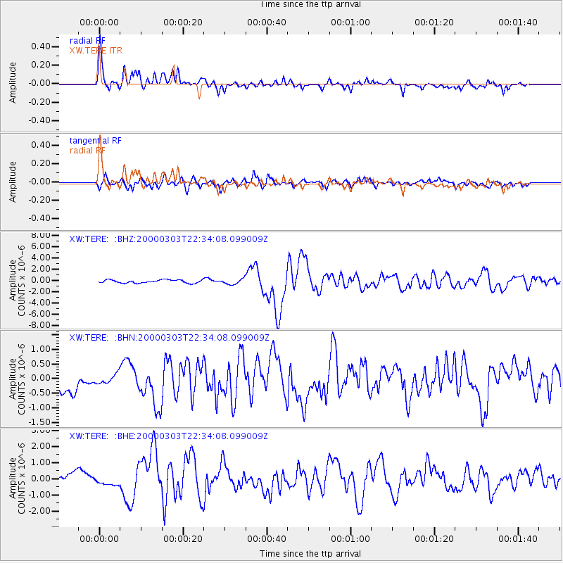
Earthquake location: New Guinea, Papua New Guinea
Earthquake latitude/longitude: -6.8/143.8
Earthquake time(UTC): 2000/03/03 (063) 22:22:40 GMT
Earthquake Depth: 10 km
Earthquake Magnitude: 6.3 MB, 6.7 MS, 6.6 MW, 6.5 MW
Earthquake Catalog/Contributor: WHDF/NEIC
Network: XW Tien Shan Continental Dynamics
Station: TERE XW.TERE
Lat/Lon: 40.48 N/75.77 E
Elevation: 3684 m
Distance: 78.0 deg
Az: 313.686 deg
Baz: 109.72 deg
Ray Param: 0.049907144
Estimated Moho Depth: 61.5 km
Estimated Crust Vp/Vs: 1.62
Assumed Crust Vp: 6.491 km/s
Estimated Crust Vs: 4.013 km/s
Estimated Crust Poisson's Ratio: 0.19
Radial Match: 82.593895 %
Radial Bump: 400
Transverse Match: 79.79871 %
Transverse Bump: 400
SOD ConfigId: 3744
Insert Time: 2010-02-26 15:47:27.793 +0000
GWidth: 2.5
Max Bumps: 400
Tol: 0.001

Signal To Noise

ChannelStoNSTALTA
XW:TERE: :BHN:20000303T22:34:08.099009Z0.394680051.6859477E-74.271682E-7
XW:TERE: :BHE:20000303T22:34:08.099009Z0.67358313.319473E-74.928082E-7
XW:TERE: :BHZ:20000303T22:34:08.099009Z1.79327054.965014E-72.7686923E-7
Arrivals
Ps6.1 SECOND
PpPs24 SECOND
PsPs/PpSs30 SECOND