You are here: Home > Network List > XW97 - Tien Shan Continental Dynamics Stations List
> Station TGMT XW.TGMT > Earthquake Result Viewer
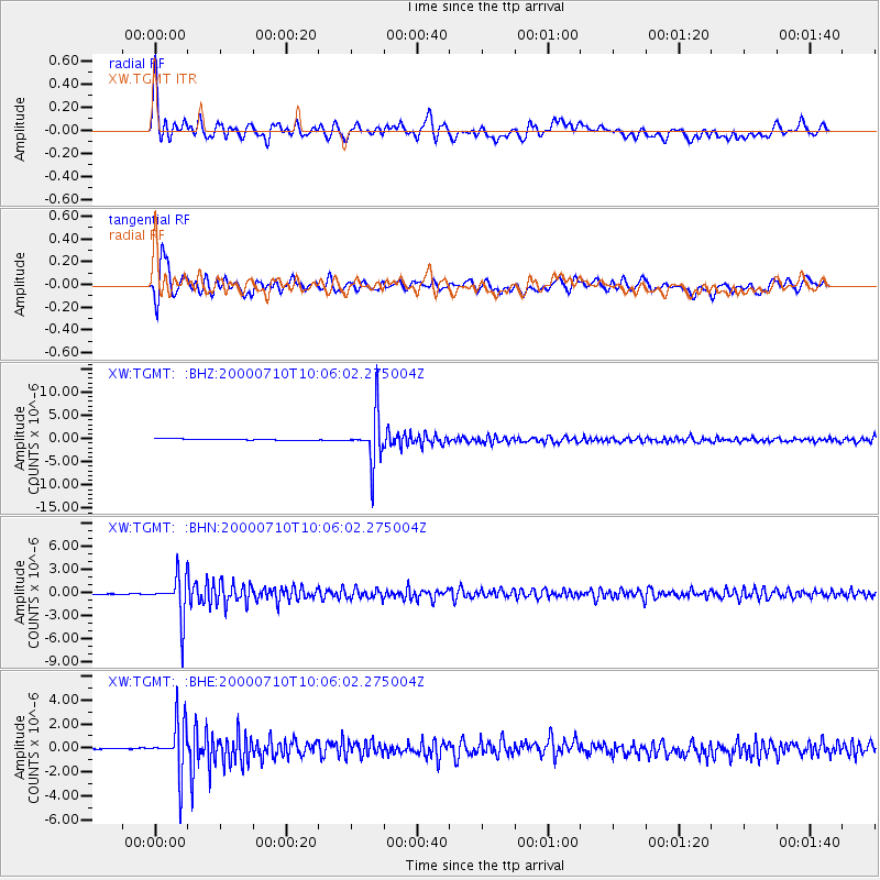
TGMT XW.TGMT - Earthquake Result Viewer

| Earthquake location: |
Sea Of Okhotsk |
| Earthquake latitude/longitude: |
46.8/145.4 |
| Earthquake time(UTC): |
2000/07/10 (192) 09:58:18 GMT |
| Earthquake Depth: |
360 km |
| Earthquake Magnitude: |
6.1 MB, 5.9 MW, 5.8 MW |
| Earthquake Catalog/Contributor: |
WHDF/NEIC |
|
| Network: |
XW Tien Shan Continental Dynamics |
| Station: |
TGMT XW.TGMT |
| Lat/Lon: |
40.00 N/76.14 E |
| Elevation: |
1823 m |
|
| Distance: |
49.3 deg |
| Az: |
288.614 deg |
| Baz: |
57.892 deg |
| Ray Param: |
0.06733737 |
| Estimated Moho Depth: |
10.25 km |
| Estimated Crust Vp/Vs: |
1.92 |
| Assumed Crust Vp: |
6.18 km/s |
| Estimated Crust Vs: |
3.215 km/s |
| Estimated Crust Poisson's Ratio: |
0.31 |
|
| Radial Match: |
92.94027 % |
| Radial Bump: |
400 |
| Transverse Match: |
91.360016 % |
| Transverse Bump: |
400 |
| SOD ConfigId: |
20082 |
| Insert Time: |
2010-02-26 15:47:51.803 +0000 |
| GWidth: |
2.5 |
| Max Bumps: |
400 |
| Tol: |
0.001 |
|
Signal To Noise
| Channel | StoN | STA | LTA |
| XW:TGMT: :BHN:20000710T10:06:02.275004Z | 45.737476 | 2.6494233E-6 | 5.7926748E-8 |
| XW:TGMT: :BHE:20000710T10:06:02.275004Z | 10.949539 | 2.1265635E-6 | 1.9421489E-7 |
| XW:TGMT: :BHZ:20000710T10:06:02.275004Z | 35.887905 | 5.1822994E-6 | 1.4440239E-7 |
| Arrivals |
| Ps | 1.6 SECOND |
| PpPs | 4.6 SECOND |
| PsPs/PpSs | 6.2 SECOND |


