TGMT XW.TGMT - Earthquake Result Viewer
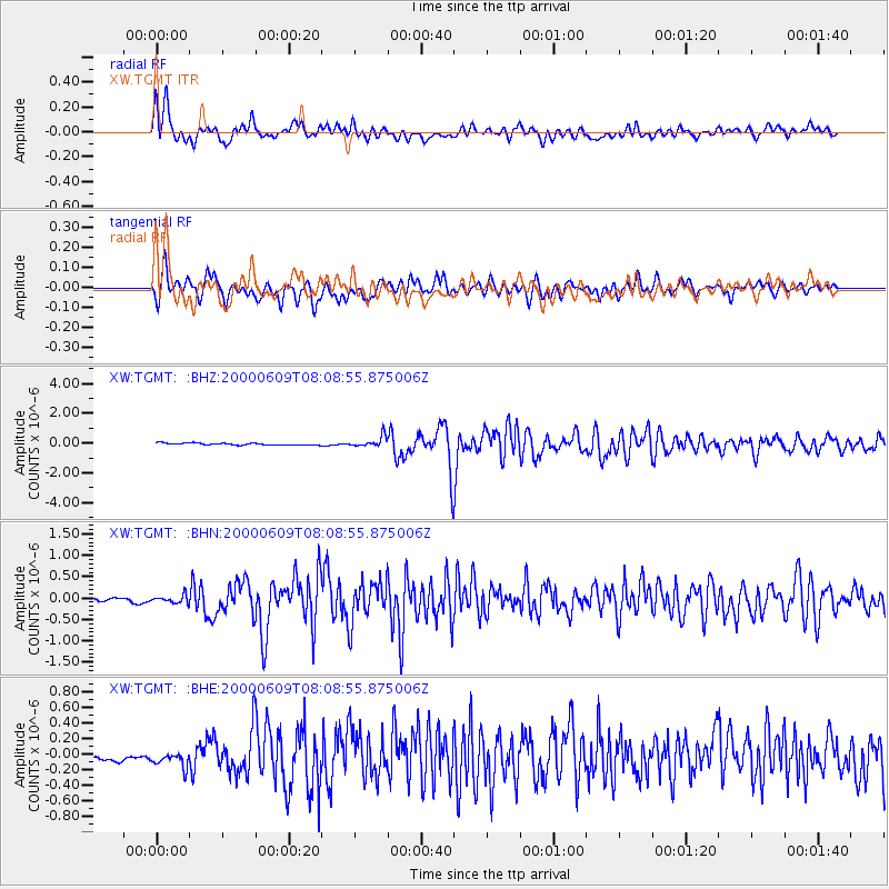
Earthquake location: Southern Sumatra, Indonesia
Earthquake latitude/longitude: -5.5/102.7
Earthquake time(UTC): 2000/06/09 (161) 08:00:24 GMT
Earthquake Depth: 33 km
Earthquake Magnitude: 5.8 MB, 5.8 MS, 6.0 MW, 6.0 MW
Earthquake Catalog/Contributor: WHDF/NEIC
Network: XW Tien Shan Continental Dynamics
Station: TGMT XW.TGMT
Lat/Lon: 40.00 N/76.14 E
Elevation: 1823 m
Distance: 51.5 deg
Az: 333.983 deg
Baz: 145.365 deg
Ray Param: 0.06731535
Estimated Moho Depth: 22.25 km
Estimated Crust Vp/Vs: 1.60
Assumed Crust Vp: 6.18 km/s
Estimated Crust Vs: 3.862 km/s
Estimated Crust Poisson's Ratio: 0.18
Radial Match: 90.63014 %
Radial Bump: 400
Transverse Match: 86.825676 %
Transverse Bump: 400
SOD ConfigId: 20082
Insert Time: 2010-02-26 15:48:05.423 +0000
GWidth: 2.5
Max Bumps: 400
Tol: 0.001

Signal To Noise

ChannelStoNSTALTA
XW:TGMT: :BHN:20000609T08:08:55.875006Z2.4552059.757668E-83.9742787E-8
XW:TGMT: :BHE:20000609T08:08:55.875006Z1.43667151.1194175E-77.791743E-8
XW:TGMT: :BHZ:20000609T08:08:55.875006Z5.53429653.5401206E-76.396695E-8
Arrivals
Ps2.3 SECOND
PpPs8.8 SECOND
PsPs/PpSs11 SECOND